Area Overview for Smallbridge & Firgrove Ward
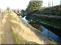
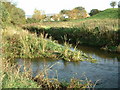
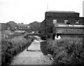
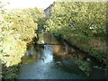
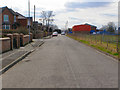
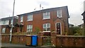
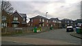
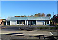
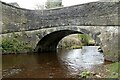
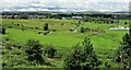
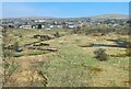
Photos of Smallbridge & Firgrove Ward

Area Information
Smallbridge & Firgrove Ward sits in the northeast corner of Rochdale metropolitan borough, occupying just 3.2 square kilometres in Greater Manchester. Although the postcode area primarily uses OL12, OL15, and OL16, the ward is distinctly adjacent to Buckley. You will find the local geography centred around coordinates approximately 53.6267°N, 2.12997°W. The population numbers 1861 residents, creating a density of 578 people per square kilometre. This concentration means everyday environments feel immediate and focused rather than sprawling. The area functions as a defined metropolitan district unitary ward with specific administrative boundaries. Living here offers a contained sense of place within a larger urban context. The location serves those who value a specific neighbourhood footprint without the vastness of broader city institutions. Your daily commute or local journey starts from a territory that is physically compact yet administratively integrated into the Rochdale structure. The ward name combines Smallbridge and Firgrove, reflecting two distinct parts of this small administrative zone. Historically, these areas have developed alongside the Rochdale Canal and textile industry, though you live primarily within modern ward boundaries set for local governance. The physical size of the ward ensures that you can walk or cycle to many immediate neighbours. You have access to a population that is tightly packed into this specific geographical slice of Greater Manchester.
- Area Type
- District Borough Unitary Ward
- Area Size
- 3.2 km²
- Population
- 1861
- Population Density
- 578 people/km²
Demographics
The community here skews significantly older than the national average, with a median age of 70 years. This age profile defines the social fabric and local service requirements. A large portion of your neighbours fall into the senior bracket, influencing where shops, healthcare, and leisure activities cluster. Exactly 48% of households belong to owners, indicating that nearly half of the residents have purchased their property outright or with a mortgage. The remaining households reside in rental properties or live with family. There is no specific data provided regarding household composition breakdowns such as single-person homes, couples, or families with children. You cannot assume a balanced mix of young families or students based on available statistics. The predominant ethnic group and specific religious affiliations are not detailed in the current information. This lack of detail means you must rely on the clear facts of age and ownership. The high median age suggests you are looking at an area where empty nesters, retirees, and their families form the core demographic. Shopping hours and local events likely cater to older lifestyles. When you visit Smallbridge & Firgrove Ward, you encounter an adult population. The residential character reflects this demographic reality without the bustle of a youthful student village or a busy commuter hub for young professionals. Your potential neighbours are mostly in their later life stages.
Household Size
Accommodation Type
Tenure
Ethnic Group
Religion
Household Composition
Age
Household Deprivation
NS-SEC
Explore more demographic insights in this area
Go to Demographics tabPlanning
Planning Constraints
- Flood RiskPremium
- Ramsar Wetland SitesPremium
- Area of Outstanding Natural BeautyPremium
- Protected Nature ReservePremium
- Protected WoodlandPremium
- Crime RiskPremium