Area Overview for Sleagill
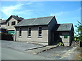
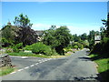
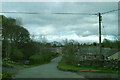
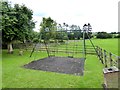
Photos of Sleagill
Area Information
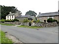
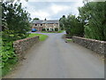
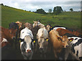
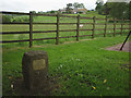
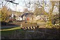
Sleagill stands as a rural civil parish within the Westmorland and Furness district of Cumbria, covering a total area of 5.6 square kilometres. This location occupies a place in the North West region, historically forming part of the ancient parish of Morland and formerly belonging to the historic county of Westmorland. Geographically, the parish sits at coordinates near 54.566°N 2.624°W, defined by its status as a small village surrounded by common land that was enclosed in 1813. As a township in the ancient parish of Morland, the area carries the weight of local governance established under the Local Government Act 1894, which created elected parish councils for rural settlements like this one. Living in Sleagill means residing in a setting that was previously part of the North Westmorland Rural District, blending historical significance with a focus on civil administration. The landscape is characterised by an acreage of 1,390 acres, offering a space that reflects its agricultural and rural roots. For anyone considering homes in Sleagill, the location provides a specific context of a small, historically defined community situated near 54.573559 latitude and -2.632637 longitude, ensuring residents have a clear understanding of their surroundings within the broader Cumbria landscape.
- Area Type
- Parish
- Area Size
- 5.6 km²
- Population
- Not available
- Population Density
- Not available
Demographics
The community profile of Sleagill reveals a resident base with a median age of 70, indicating that the population is skewed significantly towards older age groups. This demographic structure suggests a neighbourhood where the majority of households likely consist of retirees or long-standing families rather than young professionals. The local statistics show that 80% of residents achieve home ownership, a figure that signals a deeply established community where few people rent to live. This high rate of ownership often correlates with stability and a lack of transient turnover within the village. While the data does not explicitly detail ethnicity or religious composition, the overall picture of a homogenous, older population suggests a tight-knit social fabric typical of rural Cumbria. With households primarily owned rather than rented, the social dynamics likely revolve around long-term neighbours who have lived through decades of change in the region. The absence of a younger demographic in the statistics means that if you are looking for a school near Sleagill for new-borns, you may need to look to neighbouring parishes, as the catchment area here is dominated by the specific age profile recorded. Each claim regarding this area rests on the recorded median age and ownership figures, painting a clear picture of a retiree-focused rural settlement.
Household Size
Accommodation Type
Tenure
Ethnic Group
Religion
Household Composition
Age
Household Deprivation
NS-SEC
Explore more demographic insights in this area
Go to Demographics tabPlanning
Planning Constraints
- Flood RiskPremium
- Ramsar Wetland SitesPremium
- Area of Outstanding Natural BeautyPremium
- Protected Nature ReservePremium
- Protected WoodlandPremium
- Crime RiskPremium