Area Overview for Skerton Ward
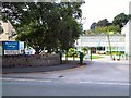
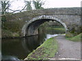
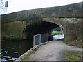
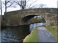
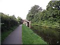
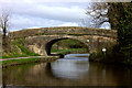
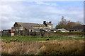
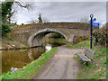
Photos of Skerton Ward
Area Information
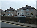
Skerton Ward occupies a distinct 2.8 km² district within the borough, presenting a compact living environment for those seeking a defined neighbourhood. This area holds a specific character shaped by its demographics, where the majority of residents are living in an environment with a median age of 70. You can expect daily life here to be quiet and established, rather than bustling with young families or rapid development. The small size means distances are short, but the community reflects a settled population that has matured over time. Living in Skerton Ward involves navigating a space where the housing stock has likely served occupants for decades, matching the age profile of the people who call it home. There is no large-scale urban infrastructure to divert traffic; instead, the ward functions as a self-contained residential area. Prospective buyers should understand this is not a rapidly changing district but a stable, older settlement. The combination of limited area size and an elderly population creates a predictable atmosphere where services cater to long-term residents. You will find a environment where the pace of life is steady, anchored by the fact that people here are simply growing older together. Homes in Skerton Ward offer a chance to be part of this specific social fabric rather than a generic urban landscape.
- Area Type
- District Borough Unitary Ward
- Area Size
- 2.8 km²
- Population
- Not available
- Population Density
- Not available
Demographics
The community within Skerton Ward is defined by an exceptionally elderly population, with a median age of 70. This figure sets the area apart from most growing urban districts where younger demographics typically drive the median age. The most common age range recorded as "Age: Total" reflects this singular focus on older residents without breakdowns for children or young adults. You are looking at a neighbourhood where the social rhythm is driven by pensioners and retired workers. Home ownership stands at 59 per cent, indicating that a little under three quarters of the population do not own their homes outright. This ownership rate suggests a significant reliance on the rental market or the presence of private landlords catering to this demographic. Household composition data is recorded simply as "total", which limits insight into family structures, yet the high age of residents implies very few households include school-aged children. Ethnicity and religious data are recorded as "total", meaning specific community diversity metrics are not available for this specific ward. Despite these general categories, five in ten people in Skerton Ward rent their home, which influences the type of housing stock available. This higher rental proportion often correlates with older bungalows or accommodation suited to mobility needs, rather than new builds for families.
Household Size
Accommodation Type
Tenure
Ethnic Group
Religion
Household Composition
Age
Household Deprivation
NS-SEC
Explore more demographic insights in this area
Go to Demographics tabPlanning
Planning Constraints
- Flood RiskPremium
- Ramsar Wetland SitesPremium
- Area of Outstanding Natural BeautyPremium
- Protected Nature ReservePremium
- Protected WoodlandPremium
- Crime RiskPremium