Area Overview for Skelmersdale North Ward
Photos of Skelmersdale North Ward
Area Information
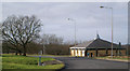
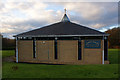
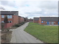
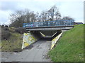
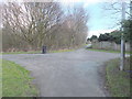
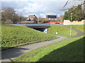
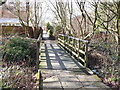
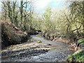
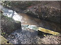
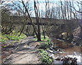
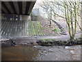
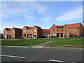
Skelmersdale North Ward forms part of the planned new town situated in a valley on the River Tawd. This electoral ward occupies a total area of 4.0 km² within the broader Skelmersdale borough in West Lancashire. The location lies approximately 6 miles west of Wigan, 13 miles north-east of Liverpool, and 15 miles south-west of Preston. The area traces its history back to the Domesday Book of 1086, with the original 'Old Town' predating much of the modern development. However, the significant growth seen today stems from the 1960s when the government designated the site as a new town following the decline of the local coal industry. Daily life here reflects the legacy of this second-wave new town. The ward is one of seven that make up the town, sitting alongside areas like Skelmersdale South. Residents enjoy living in an area where the landscape has been intentionally shaped by post-war planning. You are positioned central to the North West region, with the M58 motorway running just south of the town to link you to Wigan, the M6, and Liverpool. The A570 and A577 provide further local connections. This setting offers a balance between the structured environment of a new town and the proximity to major urban centres.
- Area Type
- District Borough Unitary Ward
- Area Size
- 4.0 km²
- Population
- Not available
- Population Density
- Not available
Demographics
The community within Skelmersdale North Ward shows a distinct leaning towards older residents. Data indicates a median age of 70 for the ward. Although the specific breakdown of the most common age range is listed as 'Total' in the source, the high median figure suggests a population largely composed of retirees or older generations who have remained in the area. This demographic profile influences the local culture and service requirements, creating a settlement that feels settled rather than transient. Home ownership is the dominant feature of household composition here. A striking 69% of residents own their homes outright or with a mortgage. This stands in contrast to rental-heavy estates where most tenants move every few years. Such a high rate of ownership typically signals a stable community where families or individuals have roots in the locality for many years. While the exact breakdown of specific accommodation types is not detailed beyond the total count, the ownership figure implies a mix of established houses and perhaps flats within the new town estates. The ward maintains a mix of ethnic groups, though the predominant group is not specified in the available statistics. The religion make-up also varies, reflecting the diverse national background of the town's history as a new town.
Household Size
Accommodation Type
Tenure
Ethnic Group
Religion
Household Composition
Age
Household Deprivation
NS-SEC
Explore more demographic insights in this area
Go to Demographics tabPlanning
Planning Constraints
- Flood RiskPremium
- Ramsar Wetland SitesPremium
- Area of Outstanding Natural BeautyPremium
- Protected Nature ReservePremium
- Protected WoodlandPremium
- Crime RiskPremium