Area Overview for SK9 7NN
Photos of SK9 7NN
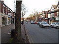
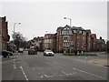
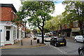


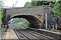


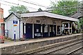

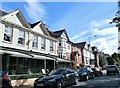
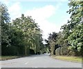
100 photos from this area
Area Information
Key information about the SK9 7NN including its size, population, and administrative classification.
- Area Type
- Postcode
- Area Size
- 8826 m²
- Population
- 1998
- Population Density
- 2286 people/km²
House Prices in SK9 7NN
24
Properties
£863,750
Average Sold Price
£130,000
Lowest Price
£1,282,500
Highest Price
Showing 24 properties
| Address | Type | Beds | Baths | Last Sale Price | Last Sale Date | |
|---|---|---|---|---|---|---|
| 46 Trafford Road, Alderley Edge, SK9 7NN | Semi-detached | 3 | 2 | £925,000 | Aug 2024 | |
| 38 Trafford Road, Alderley Edge, SK9 7NN | Semi-detached | 3 | 3 | £997,000 | Oct 2022 | |
| Holme Bush, 9 Trafford Road, Alderley Edge, SK9 7NN | house | - | - | £1,282,500 | Jul 2022 | |
| 44 Trafford Road, Alderley Edge, SK9 7NN | house | 3 | 3 | £798,000 | Jun 2021 | |
| Shellbrook, 21 Trafford Road, Alderley Edge, SK9 7NN | house | - | - | £910,000 | Aug 2020 | |
| York House, 34 Trafford Road, Alderley Edge, SK9 7NN | Semi-detached | 5 | - | £1,175,000 | Nov 2019 | |
| 19 Trafford Road, Alderley Edge, SK9 7NN | Semi-detached | 5 | - | £950,000 | Jan 2019 | |
| 11 Trafford Road, Alderley Edge, SK9 7NN | Semi-detached | 5 | 4 | £1,035,000 | Dec 2018 | |
| 17 Trafford Road, Alderley Edge, SK9 7NN | Semi-detached | 5 | 2 | £1,025,000 | Apr 2017 | |
| 25 Trafford Road, Alderley Edge, SK9 7NN | house | 4 | - | £660,000 | Nov 2013 |
Page 1 of 3
Energy Efficiency in SK9 7NN
Amenities
Schools
| Rank | School | Type | Entry gender | Ages |
|---|
Explore more schools in this area
Go to Schools tabDemographics
Household Size
One person
most common
Accommodation Type
Houses
most common
Tenure
56
majority
Ethnic Group
White
most common
Religion
N/A
most common
Household Composition
N/A
most common
Age
47
median
Adults (30-64 years)
most common
Household Deprivation
N/A
with no deprivation
NS-SEC
47
in Lower managerial occupations
Explore more demographic insights in this area
Go to Demographics tabPlanning
Planning Constraints
- Flood RiskPremium
- Ramsar Wetland SitesPremium
- Area of Outstanding Natural BeautyPremium
- Protected Nature ReservePremium
- Protected WoodlandPremium