Area Overview for SK9 7JA
Photos of SK9 7JA

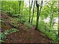
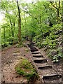
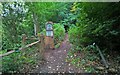

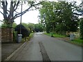
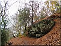
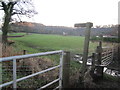
26 photos from this area
Area Information
Key information about the SK9 7JA including its size, population, and administrative classification.
- Area Type
- Postcode
- Area Size
- 11.1 hectares
- Population
- 1485
- Population Density
- 773 people/km²
House Prices in SK9 7JA
24
Properties
£828,333
Average Sold Price
£185,000
Lowest Price
£1,300,000
Highest Price
Showing 24 properties
| Address | Type | Beds | Baths | Last Sale Price | Last Sale Date | |
|---|---|---|---|---|---|---|
| Merton, 9 Moss Road, Alderley Edge, SK9 7JA | house | - | - | £985,000 | Mar 2025 | |
| Byeways, 39 Moss Road, Alderley Edge, SK9 7JA | house | - | - | £950,000 | Dec 2024 | |
| Craigside, 33 Moss Road, Alderley Edge, SK9 7JA | Detached | 3 | 2 | £1,110,000 | Mar 2024 | |
| Tregarthen, 11 Moss Road, Alderley Edge, SK9 7JA | Detached | 4 | - | £1,300,000 | Dec 2021 | |
| The Limes, 1 Moss Road, Alderley Edge, SK9 7JA | Detached | 4 | 3 | £780,000 | Jan 2021 | |
| Brambledene, 19 Moss Road, Alderley Edge, SK9 7JA | Detached | 4 | - | £730,000 | Sep 2014 | |
| Farnham Cottage, 35 Moss Road, Alderley Edge, SK9 7JA | Detached | 5 | 3 | £905,000 | Jul 2006 | |
| Broad Oak, 37 Moss Road, Alderley Edge, SK9 7JA | Detached | - | - | £510,000 | Dec 2005 | |
| Bosden Cottage, 21 Moss Road, Alderley Edge, SK9 7JA | Detached | 5 | 4 | £185,000 | Jan 1995 | |
| Kendal, 3 Moss Road, Alderley Edge, SK9 7JA | Detached | 5 | 3 | - | - |
Page 1 of 3
Energy Efficiency in SK9 7JA
Amenities
Schools
| Rank | School | Type | Entry gender | Ages |
|---|
Explore more schools in this area
Go to Schools tabDemographics
Household Size
Two person
most common
Accommodation Type
Houses
most common
Tenure
86
majority
Ethnic Group
White
most common
Religion
N/A
most common
Household Composition
N/A
most common
Age
47
median
Adults (30-64 years)
most common
Household Deprivation
N/A
with no deprivation
NS-SEC
55
in Lower managerial occupations
Explore more demographic insights in this area
Go to Demographics tabPlanning
Planning Constraints
- Flood RiskPremium
- Ramsar Wetland SitesPremium
- Area of Outstanding Natural BeautyPremium
- Protected Nature ReservePremium
- Protected WoodlandPremium