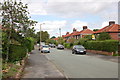
Area Overview for SK8 7SP
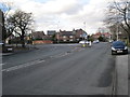
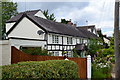
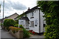
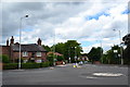
Photos of SK8 7SP


Area Information
The postcode area SK8 7SP encompasses a small residential cluster defined by a specific geographic footprint of 3057 square metres. This compact zone accommodates a population of 1671 residents within a dense living environment. You find yourself in a locality where space is at a premium, resulting in a population density that reaches approximately 546695 people per km². While these figures indicate a highly concentrated settlement, the area functions as a distinct pocket within the broader South Manchester landscape. Daily life here revolves around close proximity, meaning neighbours are often just a doorway away or a shared garden across. The area supports 1671 existing residents who navigate their routines through a tightly packed neighbourhood. For anyone considering living in SK8 7SP, the reality is one of high density where every square metre serves a purpose. The community relies on efficient use of space rather than expansive grounds. You can expect a fast-paced rhythm driven by the sheer number of people concentrated into this small footprint. It is a functional residential zone where shelter takes precedence over separation. The character of the area is defined entirely by these population dynamics and the specific boundaries of the postcode.
- Area Type
- Postcode
- Area Size
- 3057 m²
- Population
- 1671
- Population Density
- 3911 people/km²
The housing market in SK8 7SP is characterised by a stock defined almost entirely by houses. Eighty-six percent of residents own their homes, which shapes the local property landscape significantly. This high ownership rate means that new enquiries typically focus on purchases rather than rentals. The remaining 14% of residents occupy accommodation through other means, but the overwhelming majority hold freehold titles. Every dwelling in this postcode falls under the category of houses, meaning you will not find flats or multi-unit buildings here. This uniformity offers predictability for buyers seeking a traditional house layout with potential gardens. When purchasing homes in SK8 7SP, you are entering a market where long-term residents maintain their property. The 86% ownership figure indicates a community with deep roots rather than transient visitors. Buyers here look for the standard family house configuration, supported by the local infrastructure designed for ground-level living. The lack of rental stock suggests a quiet market where sales transactions drive change. Your search here targets a specific type of domestic property: the standalone house. This aligns with the demographic reality where families stay put for decades.
House Prices in SK8 7SP
Showing 4 properties
| Address | Type | Beds | Baths | Last Sale Price | Last Sale Date | |
|---|---|---|---|---|---|---|
| 4 Lyme Lea Close, Cheadle Hulme, Cheadle, SK8 7SP | Detached | - | - | £775,000 | Jan 2019 | |
| 3 Lyme Lea Close, Cheadle Hulme, Cheadle, SK8 7SP | house | - | - | £625,000 | Oct 2017 | |
| 1 Lyme Lea Close, Cheadle Hulme, Cheadle, SK8 7SP | Detached | - | - | £325,000 | Jul 2002 | |
| 2 Lyme Lea Close, Cheadle Hulme, Cheadle, SK8 7SP | Detached | - | - | £313,000 | Jul 2002 |
Energy Efficiency in SK8 7SP
Living in SK8 7SP places you within practical reach of significant retail and transport hubs. Shoppers can easily visit M&S Cheadle Hulme BP, Co-op Gill, and Tesco Cheadle for groceries and essential goods. Your weekly shopping trips save time because these stores lie close by. Travelers benefit from five railway stations nearby, including Cheadle Hulme Railway Station, Bramhall Railway Station, and Handforth Railway Station. These connections facilitate quick journeys into Manchester city centre or out towards rural Cheshire. Air travel remains accessible via Manchester Woodford Airport, Terminal Three Access, and Terminal One Access, all located within practical reach. The area also connects to the TRAM metro system at stops like Peel Hall, Shadowmoss, and Robinswood Road. This network of transport options ensures you can commute, run errands, or travel leisurely with ease. Dining and leisure options are integrated into the retail clusters surrounding the postcode. The presence of M&S and Co-op stores implies a convenience-focused lifestyle where supermarkets are part of the daily route. Commuters appreciate the proximity to multiple rail corridors and the metro. Your daily routine balances the quiet of a residential house with the activity of nearby stations and shops. Amenities here are functional, practical, and sufficiently close to eliminate the need for lengthy journeys.
Amenities
Schools
| Rank | School | Type | Entry gender | Ages |
|---|
Explore more schools in this area
Go to Schools tabDemographics
The community within SK8 7SP reflects a mature demographic profile with a median age of 47 years. Adults aged between 30 and 64 years constitute the most common age range in the area. This statistic suggests a neighbourhood dominated by families in their prime earning years or established households raising children. Home ownership stands at 86%, indicating that the vast majority of residents buy their homes rather than rent. This high ownership rate creates a sense of stability among the 1671 inhabitants of the postcode. The predominant ethnic group is White, aligning with broader national trends in the region. All accommodation within the area consists primarily of houses, distinguishing it from multi-story flat complexes found elsewhere. This housing stock suits the older household profile, offering private outdoor space and independence. The combination of a median age of 47 and an 86% ownership rate points to an area where people invest long-term in their immediate surroundings. You do not encounter short-term letting here; instead, residents tend to settle down. The demographic picture is clear and straightforward, built on domestic stability and a reliance on single-family housing.
Household Size
Accommodation Type
Tenure
Ethnic Group
Religion
Household Composition
Age
Household Deprivation
NS-SEC
Explore more demographic insights in this area
Go to Demographics tabPlanning
Planning Constraints
- Flood RiskPremium
- Ramsar Wetland SitesPremium
- Area of Outstanding Natural BeautyPremium
- Protected Nature ReservePremium
- Protected WoodlandPremium