Area Overview for SK8 7LF
Photos of SK8 7LF


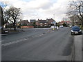
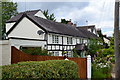
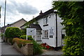
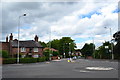
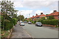
18 photos from this area
Area Information
Key information about the SK8 7LF including its size, population, and administrative classification.
- Area Type
- Postcode
- Area Size
- 2.3 hectares
- Population
- 1569
- Population Density
- 4244 people/km²
House Prices in SK8 7LF
44
Properties
£256,612
Average Sold Price
£58,000
Lowest Price
£510,000
Highest Price
Showing 44 properties
| Address | Type | Beds | Baths | Last Sale Price | Last Sale Date | |
|---|---|---|---|---|---|---|
| 27 The Circuit, Cheadle Hulme, Cheadle, SK8 7LF | Semi-detached | 4 | 2 | £510,000 | Jul 2025 | |
| 63 The Circuit, Cheadle Hulme, Cheadle, SK8 7LF | Semi-detached | 3 | 1 | £415,000 | Mar 2025 | |
| 9 The Circuit, Cheadle Hulme, Cheadle, SK8 7LF | house | - | - | £395,000 | Nov 2021 | |
| 85 The Circuit, Cheadle Hulme, Cheadle, SK8 7LF | house | - | - | £407,500 | Aug 2021 | |
| 37 The Circuit, Cheadle Hulme, Cheadle, SK8 7LF | house | - | - | £310,000 | Jun 2021 | |
| 87 The Circuit, Cheadle Hulme, Cheadle, SK8 7LF | Semi-detached | 5 | 2 | £460,000 | Dec 2020 | |
| 15 The Circuit, Cheadle Hulme, Cheadle, SK8 7LF | Semi-detached | 4 | 2 | £415,000 | Sep 2020 | |
| 35 The Circuit, Cheadle Hulme, Cheadle, SK8 7LF | house | 2 | - | £389,950 | Jan 2020 | |
| 29 The Circuit, Cheadle Hulme, Cheadle, SK8 7LF | Semi-detached | 4 | 2 | £435,000 | Jun 2019 | |
| 19 The Circuit, Cheadle Hulme, Cheadle, SK8 7LF | Semi-detached | 4 | 2 | £365,000 | Oct 2018 |
Page 1 of 5
Energy Efficiency in SK8 7LF
Amenities
Schools
| Rank | School | Type | Entry gender | Ages |
|---|
Explore more schools in this area
Go to Schools tabDemographics
Household Size
Family (3-5 people)
most common
Accommodation Type
Houses
most common
Tenure
78
majority
Ethnic Group
White
most common
Religion
N/A
most common
Household Composition
N/A
most common
Age
47
median
Adults (30-64 years)
most common
Household Deprivation
N/A
with no deprivation
NS-SEC
44
in Lower managerial occupations
Explore more demographic insights in this area
Go to Demographics tabPlanning
Planning Constraints
- Flood RiskPremium
- Ramsar Wetland SitesPremium
- Area of Outstanding Natural BeautyPremium
- Protected Nature ReservePremium
- Protected WoodlandPremium