Area Overview for SK8 6RG
Photos of SK8 6RG
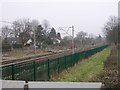
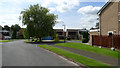
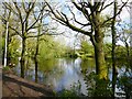

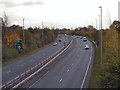
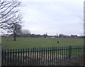
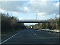


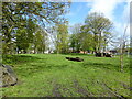
10 photos from this area
Area Information
Key information about the SK8 6RG including its size, population, and administrative classification.
- Area Type
- Postcode
- Area Size
- 1.1 hectares
- Population
- 2083
- Population Density
- 1780 people/km²
House Prices in SK8 6RG
16
Properties
£393,209
Average Sold Price
£225,000
Lowest Price
£535,000
Highest Price
Showing 16 properties
| Address | Type | Beds | Baths | Last Sale Price | Last Sale Date | |
|---|---|---|---|---|---|---|
| 21 Eden Park Road, Cheadle Hulme, Cheadle, SK8 6RG | Detached | 4 | 2 | £535,000 | Jul 2023 | |
| 2 Eden Park Road, Cheadle Hulme, Cheadle, SK8 6RG | house | - | - | £440,000 | Dec 2020 | |
| 19 Eden Park Road, Cheadle Hulme, Cheadle, SK8 6RG | Detached | 4 | 2 | £467,000 | Dec 2018 | |
| 16 Eden Park Road, Cheadle Hulme, Cheadle, SK8 6RG | house | - | - | £475,000 | Mar 2018 | |
| 6 Eden Park Road, Cheadle Hulme, Cheadle, SK8 6RG | Detached | 4 | 2 | £425,000 | Aug 2017 | |
| 14 Eden Park Road, Cheadle Hulme, Cheadle, SK8 6RG | Detached | 4 | 2 | £365,000 | Mar 2015 | |
| 8 Eden Park Road, Cheadle Hulme, Cheadle, SK8 6RG | Detached | 4 | 2 | £325,000 | Jun 2014 | |
| 15 Eden Park Road, Cheadle Hulme, Cheadle, SK8 6RG | Detached | 4 | 2 | £365,500 | Nov 2011 | |
| 7 Eden Park Road, Cheadle Hulme, Cheadle, SK8 6RG | Detached | 4 | 2 | £527,800 | Jul 2008 | |
| 17 Eden Park Road, Cheadle Hulme, Cheadle, SK8 6RG | Detached | - | - | £364,950 | Mar 2008 |
Page 1 of 2
Energy Efficiency in SK8 6RG
Amenities
Schools
| Rank | School | Type | Entry gender | Ages |
|---|
Explore more schools in this area
Go to Schools tabDemographics
Household Size
Family (3-5 people)
most common
Accommodation Type
Houses
most common
Tenure
90
majority
Ethnic Group
White
most common
Religion
N/A
most common
Household Composition
N/A
most common
Age
47
median
Adults (30-64 years)
most common
Household Deprivation
N/A
with no deprivation
NS-SEC
44
in Lower managerial occupations
Explore more demographic insights in this area
Go to Demographics tabPlanning
Planning Constraints
- Flood RiskPremium
- Ramsar Wetland SitesPremium
- Area of Outstanding Natural BeautyPremium
- Protected Nature ReservePremium
- Protected WoodlandPremium