Area Overview for SK8 6JZ
Photos of SK8 6JZ
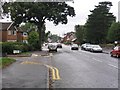
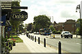
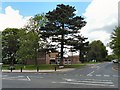


77 photos from this area
Area Information
Key information about the SK8 6JZ including its size, population, and administrative classification.
- Area Type
- Postcode
- Area Size
- 2.7 hectares
- Population
- 1565
- Population Density
- 3466 people/km²
House Prices in SK8 6JZ
36
Properties
£406,820
Average Sold Price
£73,000
Lowest Price
£1,050,000
Highest Price
Showing 36 properties
| Address | Type | Beds | Baths | Last Sale Price | Last Sale Date | |
|---|---|---|---|---|---|---|
| 69 Hulme Hall Road, Cheadle Hulme, Cheadle, SK8 6JZ | Detached | 4 | 2 | £748,000 | Sep 2025 | |
| 52 Hulme Hall Road, Cheadle Hulme, Cheadle, SK8 6JZ | house | - | - | £261,000 | Apr 2022 | |
| 71 Hulme Hall Road, Cheadle Hulme, Cheadle, SK8 6JZ | house | - | - | £725,000 | Jun 2021 | |
| Birch House Nursing Home, 62 Hulme Hall Road, Cheadle Hulme, Cheadle, SK8 6JZ | house | - | - | £1,050,000 | Aug 2019 | |
| Beechwood, 64A Hulme Hall Road, Cheadle Hulme, Cheadle, SK8 6JZ | house | - | - | £535,000 | Mar 2018 | |
| 58 Hulme Hall Road, Cheadle Hulme, Cheadle, SK8 6JZ | Detached | - | - | £160,000 | Aug 2006 | |
| 67 Hulme Hall Road, Cheadle Hulme, Cheadle, SK8 6JZ | house | - | - | £294,250 | Jun 2004 | |
| 56 Hulme Hall Road, Cheadle Hulme, Cheadle, SK8 6JZ | house | - | - | £125,000 | Aug 2003 | |
| 54 Hulme Hall Road, Cheadle Hulme, Cheadle, SK8 6JZ | Terraced | - | - | £96,950 | Feb 2000 | |
| 50 Hulme Hall Road, Cheadle Hulme, Cheadle, SK8 6JZ | Terraced | - | - | £73,000 | Feb 1996 |
Page 1 of 4
Energy Efficiency in SK8 6JZ
Amenities
Schools
| Rank | School | Type | Entry gender | Ages |
|---|
Explore more schools in this area
Go to Schools tabDemographics
Household Size
Family (3-5 people)
most common
Accommodation Type
Houses
most common
Tenure
85
majority
Ethnic Group
White
most common
Religion
N/A
most common
Household Composition
N/A
most common
Age
47
median
Adults (30-64 years)
most common
Household Deprivation
N/A
with no deprivation
NS-SEC
51
in Lower managerial occupations
Explore more demographic insights in this area
Go to Demographics tabPlanning
Planning Constraints
- Flood RiskPremium
- Ramsar Wetland SitesPremium
- Area of Outstanding Natural BeautyPremium
- Protected Nature ReservePremium
- Protected WoodlandPremium