Area Overview for SK8 6HN
Photos of SK8 6HN
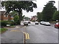
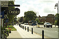
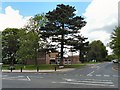
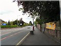
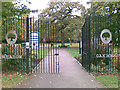


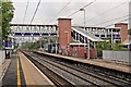

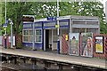
77 photos from this area
Area Information
Key information about the SK8 6HN including its size, population, and administrative classification.
- Area Type
- Postcode
- Area Size
- 3.2 hectares
- Population
- 1565
- Population Density
- 3466 people/km²
House Prices in SK8 6HN
53
Properties
£251,939
Average Sold Price
£810
Lowest Price
£645,000
Highest Price
Showing 53 properties
| Address | Type | Beds | Baths | Last Sale Price | Last Sale Date | |
|---|---|---|---|---|---|---|
| 97 Nursery Road, Cheadle Hulme, Cheadle, SK8 6HN | Semi-detached | 3 | 1 | £352,500 | Dec 2024 | |
| 27 Nursery Road, Cheadle Hulme, Cheadle, SK8 6HN | Semi-detached | 3 | 1 | £367,000 | Apr 2024 | |
| 73 Nursery Road, Cheadle Hulme, Cheadle, SK8 6HN | Semi-detached | 3 | 1 | £380,000 | Jul 2023 | |
| Hazel Bank, Nursery Road, Cheadle Hulme, Cheadle, SK8 6HN | house | - | - | £645,000 | Apr 2023 | |
| 61 Nursery Road, Cheadle Hulme, Cheadle, SK8 6HN | house | - | - | £410,000 | Jan 2023 | |
| 1D Nursery Road, Cheadle Hulme, Cheadle, SK8 6HN | house | - | - | £475,000 | Jun 2021 | |
| 33 Nursery Road, Cheadle Hulme, Cheadle, SK8 6HN | house | - | - | £335,000 | Jun 2021 | |
| 55 Nursery Road, Cheadle Hulme, Cheadle, SK8 6HN | house | 3 | - | £350,000 | Apr 2021 | |
| 93 Nursery Road, Cheadle Hulme, Cheadle, SK8 6HN | Semi-detached | 3 | 1 | £300,000 | Jan 2021 | |
| 39 Nursery Road, Cheadle Hulme, Cheadle, SK8 6HN | Semi-detached | - | - | £810 | Jun 2019 |
Page 1 of 6
Energy Efficiency in SK8 6HN
Amenities
Schools
| Rank | School | Type | Entry gender | Ages |
|---|
Explore more schools in this area
Go to Schools tabDemographics
Household Size
Family (3-5 people)
most common
Accommodation Type
Houses
most common
Tenure
85
majority
Ethnic Group
White
most common
Religion
N/A
most common
Household Composition
N/A
most common
Age
47
median
Adults (30-64 years)
most common
Household Deprivation
N/A
with no deprivation
NS-SEC
51
in Lower managerial occupations
Explore more demographic insights in this area
Go to Demographics tabPlanning
Planning Constraints
- Flood RiskPremium
- Ramsar Wetland SitesPremium
- Area of Outstanding Natural BeautyPremium
- Protected Nature ReservePremium
- Protected WoodlandPremium