Area Overview for SK8 5EL
Photos of SK8 5EL
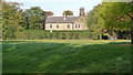
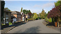
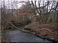

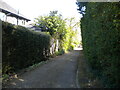
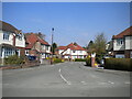
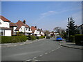
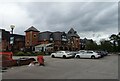
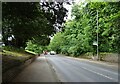
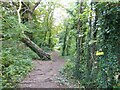
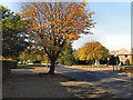
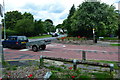
21 photos from this area
Area Information
Key information about the SK8 5EL including its size, population, and administrative classification.
- Area Type
- Postcode
- Area Size
- 9158 m²
- Population
- 1673
- Population Density
- 5418 people/km²
House Prices in SK8 5EL
21
Properties
£231,873
Average Sold Price
£69,950
Lowest Price
£405,000
Highest Price
Showing 21 properties
| Address | Type | Beds | Baths | Last Sale Price | Last Sale Date | |
|---|---|---|---|---|---|---|
| 19 Kings Road, Cheadle Hulme, Cheadle, SK8 5EL | house | - | - | £370,000 | Sep 2024 | |
| 13 Kings Road, Cheadle Hulme, Cheadle, SK8 5EL | Semi-detached | 3 | 3 | £405,000 | Jun 2023 | |
| 7 Kings Road, Cheadle Hulme, Cheadle, SK8 5EL | house | - | - | £310,000 | Dec 2020 | |
| 4 Kings Road, Cheadle Hulme, Cheadle, SK8 5EL | Semi-detached | 3 | 1 | £270,000 | May 2018 | |
| 11 Kings Road, Cheadle Hulme, Cheadle, SK8 5EL | house | - | - | £304,950 | Dec 2016 | |
| 22 Kings Road, Cheadle Hulme, Cheadle, SK8 5EL | Semi-detached | 3 | - | £249,500 | Sep 2014 | |
| 8 Kings Road, Cheadle Hulme, Cheadle, SK8 5EL | house | 3 | - | £177,500 | Mar 2010 | |
| 12 Kings Road, Cheadle Hulme, Cheadle, SK8 5EL | Semi-detached | - | - | £230,000 | Jan 2006 | |
| 10 Kings Road, Cheadle Hulme, Cheadle, SK8 5EL | Semi-detached | - | - | £195,000 | May 2004 | |
| 15 Kings Road, Cheadle Hulme, Cheadle, SK8 5EL | Semi-detached | - | - | £195,000 | Aug 2003 |
Page 1 of 3
Energy Efficiency in SK8 5EL
Amenities
Schools
| Rank | School | Type | Entry gender | Ages |
|---|
Explore more schools in this area
Go to Schools tabDemographics
Household Size
Family (3-5 people)
most common
Accommodation Type
Houses
most common
Tenure
83
majority
Ethnic Group
White
most common
Religion
N/A
most common
Household Composition
N/A
most common
Age
47
median
Adults (30-64 years)
most common
Household Deprivation
N/A
with no deprivation
NS-SEC
46
in Lower managerial occupations
Explore more demographic insights in this area
Go to Demographics tabPlanning
Planning Constraints
- Flood RiskPremium
- Ramsar Wetland SitesPremium
- Area of Outstanding Natural BeautyPremium
- Protected Nature ReservePremium
- Protected WoodlandPremium