Area Overview for SK8 4WR
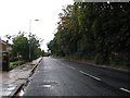
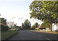
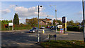
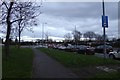
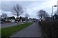
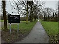
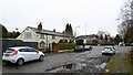
Photos of SK8 4WR


Area Information
SK8 4WR represents a specific postcode area covering a small residential cluster on the outskirts of Greater Manchester. The population stands at 1,548 people, creating a distinct neighbourhood experience that differs from larger urban centres. Living in this postcode means residing in a fairly contained environment where residents have direct access to key transport links and local retail outlets. This area sits within the Cheadle and Heald Green locality, positioning it close to the M60 motorway and Manchester Airport terminals. The character of SK8 4WR is defined by its proximity to well-established stations like Heald Green and Gatley, which facilitate easy commutes into Manchester and Stockport. You will find that daily life here revolves around practical access rather than dense urban living. The small population size often leads to quieter streets compared to the surrounding suburbs of Cheadle Hulme or Review. Despite its size, the location offers significant connectivity, with five nearby train stations and five underground stops including Shadowmoss and Peel Hall. This transport network ensures that living in SK8 4WR does not isolate you from the wider region. The area serves as a residential hub for those who require a balance between home comfort and easy access to Manchester's employment districts without the pressures of city centre congestion.
- Area Type
- Postcode
- Area Size
- Not available
- Population
- 1548
- Population Density
- 1862 people/km²
The housing market in SK8 4WR is characterised by a strong bias towards owner-occupancy. With 88% of residents owning their homes, the area functions as a traditional residential zone rather than a landlord-build-to-rent corridor. This statistic implies that the local property stock values are driven by owner-motivated selling rather than investment portfolios. If you are looking at homes in SK8 4WR, you will primarily encounter semi-detached, detached, or terraced houses rather than apartment blocks. The fact that the predominant accommodation type is houses reinforces the suitability of this area for families seeking rear gardens and private outdoor space. A high level of home ownership often signals that properties have undergone significant personal investment over time. Buyers typically find a mix of original character homes and modernised versions of standard suburban designs. Because this is a small residential cluster, there may be fewer properties on the market at any single moment compared to larger postcodes. However, the concentration of owner-occupiers means that when a home becomes available, it is often being sold by someone who knows the area intimately. This transparency can streamline the purchasing process for serious buyers. The market here rewards those who understand the value of established neighbourhoods over speculative developments.
House Prices in SK8 4WR
No properties found in this postcode.
Energy Efficiency in SK8 4WR
Daily life in SK8 4WR benefits from a convenient array of retail and leisure options within easy reach. Residents have access to five notable amenities covering grocery shopping and daily needs. Sainsburys Cheadle, Co-op Heald, and Spar Heald form the core of the local retail landscape, offering everything from fresh produce to household essentials. You do not need to travel far to find your weekly shopping or grab a quick coffee on your way home. The concentration of these supermarkets means the area functions as a reliable local hub for household management. Beyond retail, the area is well-connected to leisure facilities through its transport links. The five nearby railway stations and five Metrolink stops facilitate easy trips to wider entertainment districts. Access to Manchester Airport terminals one, two, and three also provides residents with a unique connection to global travel hubs. While specific parks or leisure centres are not detailed in the immediate proximity list, the transport infrastructure ensures you can reach the wider Greater Manchester leisure network efficiently. This blend of local convenience and easy regional access defines the character of living in SK8 4WR, offering a self-sufficient neighbourhood without isolating you from the larger city's opportunities.
Amenities
Schools
Families with children have access to a robust selection of educational institutions near SK8 4WR. Prospective parents can choose from Prospect Vale Primary School, North Cheshire Jewish Primary School, and North West Hospital School. All three listed establishments hold a Good Ofsted rating, providing a consistently high standard of education for local children. The mix includes state-funded primary schools and an independent option, offering families flexibility in selecting an academic environment that aligns with their values. Living in SK8 4WR places you within practical commuting distance of these well-regarded facilities. North Cheshire Jewish Primary School serves a specific community need while maintaining the same high standards as its counterparts. Prospect Vale Primary School represents the mainstream state sector option, integrated into the local catchment areas of Cheadle and Heald Green. Having multiple schools with Good ratings across different types means you do not face scarcity when researching schools near SK8 4WR. The presence of an independent school in the list also indicates that the area attracts families who might choose private education, suggesting a neighbourhood that values educational choice alongside public provision.
| Rank | School | Type | Entry gender | Ages |
|---|
Explore more schools in this area
Go to Schools tabDemographics
The community within SK8 4WR reflects a mature and established residential profile. The median age for residents is 47 years, with the most common age range comprising adults between 30 and 64 years old. This demographic structure suggests the area is suited to families with older children, empty nesters, and professionals in mid-career stages. Home ownership is exceptionally high, with 88% of households in this postcode owning their homes outright or with a significant portion of the mortgage paid. This figure indicates a stable community where long-term residents often stay for decades. Accommodation in SK8 4WR consists almost entirely of houses, distinguishing it from areas dominated by high-rise flats or purpose-built rental blocks. The predominant ethnic group is White, aligning with the broader demographic trends of the suburban stockport and salford corridor. These figures paint a picture of a settled neighbourhood where residents have likely invested heavily in their local properties. The low percentage of rental occupants and high home ownership rate means you are entering a market defined by stability rather than transient turnover. When considering living in SK8 4WR, you are joining a community where neighbours have deep roots and a shared understanding of local history and development patterns.
Household Size
Accommodation Type
Tenure
Ethnic Group
Religion
Household Composition
Age
Household Deprivation
NS-SEC
Explore more demographic insights in this area
Go to Demographics tabPlanning
Planning Constraints
- Flood RiskPremium
- Ramsar Wetland SitesPremium
- Area of Outstanding Natural BeautyPremium
- Protected Nature ReservePremium
- Protected WoodlandPremium