Area Overview for SK8 4PH
Photos of SK8 4PH
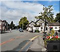
57 photos from this area
Area Information
Key information about the SK8 4PH including its size, population, and administrative classification.
- Area Type
- Postcode
- Area Size
- 1.8 hectares
- Population
- 1550
- Population Density
- 3518 people/km²
House Prices in SK8 4PH
31
Properties
£341,087
Average Sold Price
£100,000
Lowest Price
£565,000
Highest Price
Showing 31 properties
| Address | Type | Beds | Baths | Last Sale Price | Last Sale Date | |
|---|---|---|---|---|---|---|
| 6 Delamere Road, Gatley, Cheadle, SK8 4PH | house | - | - | £415,000 | Mar 2021 | |
| 39 Delamere Road, Gatley, Cheadle, SK8 4PH | house | - | - | £370,000 | Mar 2021 | |
| 1 Delamere Road, Gatley, Cheadle, SK8 4PH | house | - | - | £395,000 | Dec 2020 | |
| 27 Delamere Road, Gatley, Cheadle, SK8 4PH | house | - | - | £565,000 | Sep 2020 | |
| 35 Delamere Road, Gatley, Cheadle, SK8 4PH | house | - | - | £445,500 | Aug 2020 | |
| 9 Delamere Road, Gatley, Cheadle, SK8 4PH | Detached | 5 | - | £434,000 | Jan 2017 | |
| 5 Delamere Road, Gatley, Cheadle, SK8 4PH | Detached | 5 | - | £530,000 | Aug 2014 | |
| 3 Delamere Road, Gatley, Cheadle, SK8 4PH | Detached | - | - | £417,500 | Nov 2009 | |
| 14 Delamere Road, Gatley, Cheadle, SK8 4PH | house | - | - | £400,000 | Dec 2008 | |
| 12 Delamere Road, Gatley, Cheadle, SK8 4PH | Detached | - | - | £379,950 | Aug 2007 |
Page 1 of 4
Energy Efficiency in SK8 4PH
Amenities
Schools
| Rank | School | Type | Entry gender | Ages |
|---|
Explore more schools in this area
Go to Schools tabDemographics
Household Size
Family (3-5 people)
most common
Accommodation Type
Houses
most common
Tenure
84
majority
Ethnic Group
White
most common
Religion
N/A
most common
Household Composition
N/A
most common
Age
47
median
Adults (30-64 years)
most common
Household Deprivation
N/A
with no deprivation
NS-SEC
46
in Lower managerial occupations
Explore more demographic insights in this area
Go to Demographics tabPlanning
Planning Constraints
- Flood RiskPremium
- Ramsar Wetland SitesPremium
- Area of Outstanding Natural BeautyPremium
- Protected Nature ReservePremium
- Protected WoodlandPremium