Area Overview for SK8 4LF
Photos of SK8 4LF
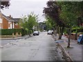
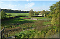
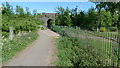
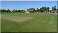
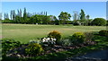
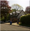
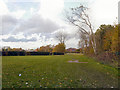
21 photos from this area
Area Information
Key information about the SK8 4LF including its size, population, and administrative classification.
- Area Type
- Postcode
- Area Size
- 8368 m²
- Population
- 1633
- Population Density
- 2268 people/km²
House Prices in SK8 4LF
15
Properties
£300,172
Average Sold Price
£198,000
Lowest Price
£490,000
Highest Price
Showing 15 properties
| Address | Type | Beds | Baths | Last Sale Price | Last Sale Date | |
|---|---|---|---|---|---|---|
| 16 Keswick Avenue, Gatley, Cheadle, SK8 4LF | Bungalow | 2 | 1 | £272,812 | May 2025 | |
| 14 Keswick Avenue, Gatley, Cheadle, SK8 4LF | Bungalow | 3 | 1 | £335,000 | Feb 2024 | |
| 26 Keswick Avenue, Gatley, Cheadle, SK8 4LF | Detached | 4 | 2 | £490,000 | Oct 2023 | |
| 32 Keswick Avenue, Gatley, Cheadle, SK8 4LF | Detached | 2 | 1 | £255,000 | Jul 2021 | |
| 28 Keswick Avenue, Gatley, Cheadle, SK8 4LF | Bungalow | - | - | £220,300 | Feb 2021 | |
| 18 Keswick Avenue, Gatley, Cheadle, SK8 4LF | house | - | - | £330,000 | Jun 2019 | |
| 12 Keswick Avenue, Gatley, Cheadle, SK8 4LF | Bungalow | 2 | 1 | £225,000 | Apr 2018 | |
| 30 Keswick Avenue, Gatley, Cheadle, SK8 4LF | Bungalow | - | - | £198,000 | Sep 2017 | |
| 6 Keswick Avenue, Gatley, Cheadle, SK8 4LF | Detached | 4 | 1 | £344,000 | Jun 2016 | |
| 8 Keswick Avenue, Gatley, Cheadle, SK8 4LF | house | - | - | £363,000 | Nov 2011 |
Page 1 of 2
Energy Efficiency in SK8 4LF
Amenities
Schools
| Rank | School | Type | Entry gender | Ages |
|---|
Explore more schools in this area
Go to Schools tabDemographics
Household Size
Two person
most common
Accommodation Type
Houses
most common
Tenure
91
majority
Ethnic Group
White
most common
Religion
N/A
most common
Household Composition
N/A
most common
Age
47
median
Adults (30-64 years)
most common
Household Deprivation
N/A
with no deprivation
NS-SEC
45
in Lower managerial occupations
Explore more demographic insights in this area
Go to Demographics tabPlanning
Planning Constraints
- Flood RiskPremium
- Ramsar Wetland SitesPremium
- Area of Outstanding Natural BeautyPremium
- Protected Nature ReservePremium
- Protected WoodlandPremium