Area Overview for SK8 3TB
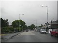
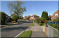
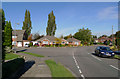
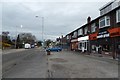
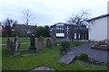
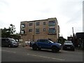
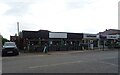
Photos of SK8 3TB

Area Information
You are looking at just 8,071 square metres in the SK8 3TB postcode, which covers only a small residential cluster. This tiny footprint supports a population of 2,083 people, creating a density of 1,780 people per square kilometre. Living in SK8 3TB means sharing high-rise living with a significant number of neighbours in a confined space. The area is defined by its concentration of homes within a very limited geographical boundary. This density contrasts with the large rural spaces often found elsewhere in the Cheshire and Manchester region. Despite its small size, the area serves as a practical base for commuters heading towards major business hubs or older parts of Greater Manchester. The compact nature of the postcode suggests a neighbourhood where daily walks may cover substantial portions of the local journey to key amenities. You will find yourself surrounded by a tight-knit group of residents who rely on nearby rail links and transport networks for their broader mobility needs.
- Area Type
- Postcode
- Area Size
- 8071 m²
- Population
- 2083
- Population Density
- 1780 people/km²
Homes in SK8 3TB are primarily traditional houses rather than flats or apartments. The accommodation type data confirms that houses form the standard stock for this residential cluster. This structure supports a high level of home ownership, with 90% of residents owning their dwellings. Such a high ownership rate typically indicates an area where buyers have made significant investments rather than short-term renters. When looking at properties near SK8 3TB, you will mainly view detached, semi-detached, or terraced houses suitable for families or professionals working in the region. The lack of flat listings in the data suggests that this postcode does not cater to the rental market or young professionals seeking urban apartments. Instead, the market focuses on individuals and families capable of purchasing a house. If you are searching for a mortgage product or a family-sized home, this postcode offers a traditional property environment.
House Prices in SK8 3TB
Showing 17 properties
| Address | Type | Beds | Baths | Last Sale Price | Last Sale Date | |
|---|---|---|---|---|---|---|
| 1 Chantler Close, Heald Green, Cheadle, SK8 3TB | house | - | - | £402,500 | Jun 2023 | |
| 4 Chantler Close, Heald Green, Cheadle, SK8 3TB | house | - | - | £83,476 | Jun 2023 | |
| 2 Chantler Close, Heald Green, Cheadle, SK8 3TB | house | - | - | £559,995 | Mar 2023 | |
| 5 Chantler Close, Heald Green, Cheadle, SK8 3TB | house | - | - | - | - | |
| 14 Chantler Close, Heald Green, Cheadle, SK8 3TB | house | - | - | - | - | |
| 11 Chantler Close, Heald Green, Cheadle, SK8 3TB | house | - | - | - | - | |
| 15 Chantler Close, Heald Green, Cheadle, SK8 3TB | house | - | - | - | - | |
| 8 Chantler Close, Heald Green, Cheadle, SK8 3TB | house | - | - | - | - | |
| 10 Chantler Close, Heald Green, Cheadle, SK8 3TB | house | - | - | - | - | |
| 13 Chantler Close, Heald Green, Cheadle, SK8 3TB | house | - | - | - | - |
Energy Efficiency in SK8 3TB
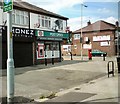
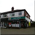
Daily life in SK8 3TB centres on a selection of local retail and transport nodes. You have access to five retail outlets, including Co-op Heald, Morrisons Daily, and Spar Heald. These shops provide essential groceries and daily necessities within a short walk from most homes. Transport options are extensive, with five railway stations and five metro stops identified near the area. Heald Green, Handforth, and Cheadle Hulme serve as the primary rail interchange points for your journey. Public transport links include stops at Shadowmoss, Peel Hall, and Robinswood Road. If air travel is required, Terminal One and Terminal Three access points are nearby, alongside the main Manchester Airport hub. These amenities eliminate the need for long commutes to the city centre for basic shopping or travel. The proximity of these specific venues creates a convenient lifestyle where you can resolve daily needs without travelling far.
Amenities
Schools
There are four educational institutions listed directly as being nearby to SK8 3TB. Cheadle Preparatory School is an independent school catering to younger scholars. For families with special needs, the Royal School, Manchester and Ivy Cottage Residential School provide specialist education. Willow House School also operates as a special school with an Ofsted rating of satisfactory. Students from SK8 3TB can potentially access these facilities depending on their specific educational needs and catchment areas. The mix of independent and special schools suggests that parents often opt for private education or require specific support services that the local state sector may not always provide. You will not find comprehensive schools with wide catchment areas listed in the immediate proximity data. The presence of a satisfactory rated school ensures some regulation is in place for the special needs provision in the vicinity.
| Rank | School | Type | Entry gender | Ages |
|---|
Explore more schools in this area
Go to Schools tabDemographics
The community within SK8 3TB is dominated by adults aged between 30 and 64 years. The median age for residents is 47, indicating a mature population with long-standing ties to the location. This aligns with the high rate of home ownership, where 90% of households own their property outright or with a mortgage. You will find houses as the primary form of accommodation, rather than high-rise developments or purpose-built rentals. The predominant ethnic group is White, reflecting the established character of the housing stock in this specific postcode. Given the high ownership rate, the area appeals strongly to those seeking stability and rooted communities rather than transient living situations. The age profile suggests families with older children or retirees who have settled down in their homes. You are not likely to encounter a transient population here, as the majority of residents have a direct financial stake in the properties they occupy.
Household Size
Accommodation Type
Tenure
Ethnic Group
Religion
Household Composition
Age
Household Deprivation
NS-SEC
Explore more demographic insights in this area
Go to Demographics tabPlanning
Planning Constraints
- Flood RiskPremium
- Ramsar Wetland SitesPremium
- Area of Outstanding Natural BeautyPremium
- Protected Nature ReservePremium
- Protected WoodlandPremium