Area Overview for SK8 2DT
Photos of SK8 2DT


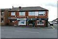
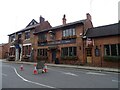
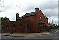
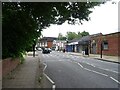

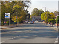
44 photos from this area
Area Information
Key information about the SK8 2DT including its size, population, and administrative classification.
- Area Type
- Postcode
- Area Size
- 2.6 hectares
- Population
- 1408
- Population Density
- 4312 people/km²
House Prices in SK8 2DT
54
Properties
£208,717
Average Sold Price
£80,000
Lowest Price
£389,950
Highest Price
Showing 54 properties
| Address | Type | Beds | Baths | Last Sale Price | Last Sale Date | |
|---|---|---|---|---|---|---|
| 49 Cuthbert Road, Cheadle, SK8 2DT | Terraced | 3 | 1 | £363,000 | Mar 2025 | |
| 32 Cuthbert Road, Cheadle, SK8 2DT | Semi-detached | 3 | 1 | £320,000 | Feb 2025 | |
| 23 Cuthbert Road, Cheadle, SK8 2DT | house | - | - | £350,000 | Oct 2023 | |
| 37 Cuthbert Road, Cheadle, SK8 2DT | Semi-detached | 3 | 1 | £320,000 | Jun 2023 | |
| 26 Cuthbert Road, Cheadle, SK8 2DT | Semi-detached | 2 | 1 | £389,950 | Dec 2022 | |
| 19 Cuthbert Road, Cheadle, SK8 2DT | Terraced | 2 | 1 | £335,500 | Aug 2022 | |
| 15 Cuthbert Road, Cheadle, SK8 2DT | Terraced | 2 | 1 | £291,000 | Apr 2021 | |
| 56 Cuthbert Road, Cheadle, SK8 2DT | Semi-detached | 3 | 1 | £289,950 | Mar 2021 | |
| 42 Cuthbert Road, Cheadle, SK8 2DT | house | - | - | £305,000 | Feb 2021 | |
| 48 Cuthbert Road, Cheadle, SK8 2DT | Semi-detached | 3 | 1 | £311,000 | Sep 2020 |
Page 1 of 6
Energy Efficiency in SK8 2DT
Amenities
Schools
| Rank | School | Type | Entry gender | Ages |
|---|
Explore more schools in this area
Go to Schools tabDemographics
Household Size
Two person
most common
Accommodation Type
Houses
most common
Tenure
83
majority
Ethnic Group
White
most common
Religion
N/A
most common
Household Composition
N/A
most common
Age
47
median
Adults (30-64 years)
most common
Household Deprivation
N/A
with no deprivation
NS-SEC
40
in Lower managerial occupations
Explore more demographic insights in this area
Go to Demographics tabPlanning
Planning Constraints
- Flood RiskPremium
- Ramsar Wetland SitesPremium
- Area of Outstanding Natural BeautyPremium
- Protected Nature ReservePremium
- Protected WoodlandPremium