Area Overview for SK8 2BZ
Photos of SK8 2BZ

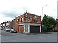
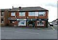
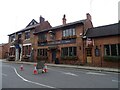
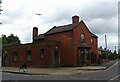
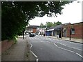
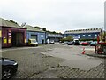
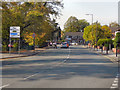
44 photos from this area
Area Information
Key information about the SK8 2BZ including its size, population, and administrative classification.
- Area Type
- Postcode
- Area Size
- 2.1 hectares
- Population
- 1472
- Population Density
- 5462 people/km²
House Prices in SK8 2BZ
42
Properties
£180,429
Average Sold Price
£51,000
Lowest Price
£425,500
Highest Price
Showing 42 properties
| Address | Type | Beds | Baths | Last Sale Price | Last Sale Date | |
|---|---|---|---|---|---|---|
| 1 Shakespeare Drive, Cheadle, SK8 2BZ | Semi-detached | 3 | 1 | £275,000 | Mar 2025 | |
| 73 Shakespeare Drive, Cheadle, SK8 2BZ | house | - | - | £349,950 | Sep 2023 | |
| 9 Shakespeare Drive, Cheadle, SK8 2BZ | Semi-detached | 3 | 2 | £425,500 | Jul 2023 | |
| 17 Shakespeare Drive, Cheadle, SK8 2BZ | Bungalow | 3 | 1 | £386,000 | Feb 2023 | |
| 43 Shakespeare Drive, Cheadle, SK8 2BZ | Semi-detached | 3 | - | £385,000 | Apr 2022 | |
| 45 Shakespeare Drive, Cheadle, SK8 2BZ | Bungalow | - | - | £255,000 | Jun 2021 | |
| 69 Shakespeare Drive, Cheadle, SK8 2BZ | house | - | - | £295,000 | Jun 2021 | |
| 3 Shakespeare Drive, Cheadle, SK8 2BZ | Bungalow | - | - | £200,000 | Oct 2020 | |
| 39 Shakespeare Drive, Cheadle, SK8 2BZ | Bungalow | - | - | £175,000 | Sep 2016 | |
| 11 Shakespeare Drive, Cheadle, SK8 2BZ | Semi-detached | - | - | £69,000 | Aug 2016 |
Page 1 of 5
Energy Efficiency in SK8 2BZ
Amenities
Schools
| Rank | School | Type | Entry gender | Ages |
|---|
Explore more schools in this area
Go to Schools tabDemographics
Household Size
Family (3-5 people)
most common
Accommodation Type
Houses
most common
Tenure
85
majority
Ethnic Group
White
most common
Religion
N/A
most common
Household Composition
N/A
most common
Age
47
median
Adults (30-64 years)
most common
Household Deprivation
N/A
with no deprivation
NS-SEC
38
in Lower managerial occupations
Explore more demographic insights in this area
Go to Demographics tabPlanning
Planning Constraints
- Flood RiskPremium
- Ramsar Wetland SitesPremium
- Area of Outstanding Natural BeautyPremium
- Protected Nature ReservePremium
- Protected WoodlandPremium