Area Overview for SK7 6EH
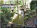
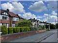
Photos of SK7 6EH
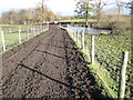
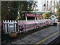
![Brookside Miniature Railway [2] in SK7 6EH](https://images.propbar.co.uk/images/geograph/43/15/4315678_120.jpg)
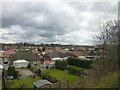
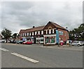
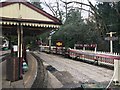
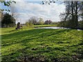

29 photos from this area
Area Information
Key information about the SK7 6EH including its size, population, and administrative classification.
- Area Type
- Postcode
- Area Size
- 1.2 hectares
- Population
- 1550
- Population Density
- 2312 people/km²
House Prices in SK7 6EH
22
Properties
£265,455
Average Sold Price
£86,500
Lowest Price
£425,000
Highest Price
Showing 22 properties
| Address | Type | Beds | Baths | Last Sale Price | Last Sale Date | |
|---|---|---|---|---|---|---|
| 70 Dean Lane, Hazel Grove, Stockport, SK7 6EH | Semi-detached | 3 | 2 | £425,000 | Nov 2025 | |
| 66 Dean Lane, Hazel Grove, Stockport, SK7 6EH | Semi-detached | 3 | 1 | £395,000 | Jul 2025 | |
| 78 Dean Lane, Hazel Grove, Stockport, SK7 6EH | Semi-detached | 3 | 3 | £395,000 | Jun 2024 | |
| 55 Dean Lane, Hazel Grove, Stockport, SK7 6EH | house | - | - | £395,000 | Oct 2018 | |
| 61 Dean Lane, Hazel Grove, Stockport, SK7 6EH | Semi-detached | 3 | 2 | £259,300 | Aug 2017 | |
| 49 Dean Lane, Hazel Grove, Stockport, SK7 6EH | house | 3 | 1 | £265,000 | May 2016 | |
| 74 Dean Lane, Hazel Grove, Stockport, SK7 6EH | Semi-detached | 4 | - | £250,000 | Sep 2012 | |
| 57 Dean Lane, Hazel Grove, Stockport, SK7 6EH | house | - | - | £230,000 | Jul 2011 | |
| 71 Dean Lane, Hazel Grove, Stockport, SK7 6EH | house | - | - | £250,000 | Mar 2011 | |
| 72 Dean Lane, Hazel Grove, Stockport, SK7 6EH | Semi-detached | - | - | £185,000 | May 2008 |
Page 1 of 3
Energy Efficiency in SK7 6EH
Amenities
Schools
| Rank | School | Type | Entry gender | Ages |
|---|
Explore more schools in this area
Go to Schools tabDemographics
Household Size
Two person
most common
Accommodation Type
Houses
most common
Tenure
97
majority
Ethnic Group
White
most common
Religion
N/A
most common
Household Composition
N/A
most common
Age
47
median
Adults (30-64 years)
most common
Household Deprivation
N/A
with no deprivation
NS-SEC
44
in Lower managerial occupations
Explore more demographic insights in this area
Go to Demographics tabPlanning
Planning Constraints
- Flood RiskPremium
- Ramsar Wetland SitesPremium
- Area of Outstanding Natural BeautyPremium
- Protected Nature ReservePremium
- Protected WoodlandPremium