Area Overview for SK7 6DG
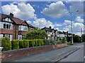
Photos of SK7 6DG
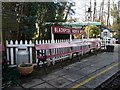
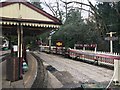
![Brookside Miniature Railway [2] in SK7 6DG](https://images.propbar.co.uk/images/geograph/43/15/4315678_120.jpg)

29 photos from this area
Area Information
Key information about the SK7 6DG including its size, population, and administrative classification.
- Area Type
- Postcode
- Area Size
- 4562 m²
- Population
- 1540
- Population Density
- 5381 people/km²
House Prices in SK7 6DG
13
Properties
-
Average Sold Price
-
Lowest Price
-
Highest Price
Showing 13 properties
| Address | Type | Beds | Baths | Last Sale Price | Last Sale Date | |
|---|---|---|---|---|---|---|
| 8A, Fiveways Parade, Cavendish Road, Hazel Grove, Stockport, SK7 6DG | Maisonette | 3 | 1 | - | - | |
| 12A, Fiveways Parade, Cavendish Road, Hazel Grove, Stockport, SK7 6DG | Maisonette | - | - | - | - | |
| 2A, Fiveways Parade, Cavendish Road, Hazel Grove, Stockport, SK7 6DG | Maisonette | 2 | 1 | - | - | |
| 9A, Fiveways Parade, Cavendish Road, Hazel Grove, Stockport, SK7 6DG | Maisonette | 3 | 1 | - | - | |
| 10B, Fiveways Parade, Cavendish Road, Hazel Grove, Stockport, SK7 6DG | Flat | - | - | - | - | |
| 11A, Fiveways Parade, Cavendish Road, Hazel Grove, Stockport, SK7 6DG | Maisonette | - | - | - | - | |
| 10A, Fiveways Parade, Cavendish Road, Hazel Grove, Stockport, SK7 6DG | Flat | - | - | - | - | |
| 5A, Fiveways Parade, Cavendish Road, Hazel Grove, Stockport, SK7 6DG | Maisonette | - | - | - | - | |
| Rj International Freight, 3A, Fiveways House, Fiveways Parade, Cavendish Road, Hazel Grove, Stockport, SK7 6DG | office_workshop | - | - | - | - | |
| 1A, Fiveways Parade, Cavendish Road, Hazel Grove, Stockport, SK7 6DG | Maisonette | 3 | 1 | - | - |
Page 1 of 2
Energy Efficiency in SK7 6DG
Amenities
Schools
| Rank | School | Type | Entry gender | Ages |
|---|
Explore more schools in this area
Go to Schools tabDemographics
Household Size
Family (3-5 people)
most common
Accommodation Type
Houses
most common
Tenure
89
majority
Ethnic Group
White
most common
Religion
N/A
most common
Household Composition
N/A
most common
Age
47
median
Adults (30-64 years)
most common
Household Deprivation
N/A
with no deprivation
NS-SEC
47
in Lower managerial occupations
Explore more demographic insights in this area
Go to Demographics tabPlanning
Planning Constraints
- Flood RiskPremium
- Ramsar Wetland SitesPremium
- Area of Outstanding Natural BeautyPremium
- Protected Nature ReservePremium
- Protected WoodlandPremium