Area Overview for SK7 6BS
Photos of SK7 6BS


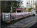
![Brookside Miniature Railway [2] in SK7 6BS](https://images.propbar.co.uk/images/geograph/43/15/4315678_120.jpg)


Area Information
SK7 6BS is a specific postcode covering a small residential cluster spanning just 1.1 hectares. This compact zone supports a population of 1,581 residents, creating a dense environment where living in the area feels intimate and immediate. The location is situated within the SK7 region, offering a focused snapshot of suburban life on the Cheshire border. Daily life here revolves around proximity, with households packed closely together in a space designed for efficiency rather than sprawl. The population density stands at 458 people per square kilometre, indicating a community where neighbours are within easy reach. This tight-knit setting distinguishes itself from larger, more spread-out districts by limiting the distance between homes and local facilities. You will find a neighbourhood where the scale of the estate matches the scale of daily routines, ensuring that essentials are never far away. The postcode serves as a defined entry point into the wider Hazel Grove and Didsbury corridor, anchoring residents at the end of their commute. For those considering homes in SK7 6BS, the defined boundaries provide a clear sense of place within the broader Manchester commute zone. ### The community in SK7 6BS reflects a mature demographic profile with a median age of 47 years. Adults aged between 30 and 64 years form the most common age range, suggesting a population in the prime working years. Home ownership levels are exceptionally high at 91%, meaning nearly every household in this postcode owns their property outright or with a mortgage. This significant majority of owners shapes the social fabric of the area, as residents here have a long-term stake in the locality. The accommodation type is exclusively houses, which aligns with the higher home ownership rate and the preference for dedicated outdoor space. The predominant ethnic group is White, which defines the current cultural composition of the neighbourhood. With a population of 1,581 people, the social interactions are frequent and direct. The high rate of home ownership in this specific cluster indicates financial stability among the residents. You are likely to encounter a community where property investment is common and transient rental populations are rare. This demographic stability means that those living in SK7 6BS are likely to invest in long-term improvements to their properties. ### Homes in SK7 6BS are predominantly houses, driving a market characterised by owner occupancy. The home ownership percentage reaches 91%, which is substantially higher than the national average. This statistic confirms the area as a primarily owner-occupied zone rather than a hub for the private rental sector. The accommodation type data shows a landscape filled with properties built for permanent residence and family establishment. When you look at homes in this postcode, you will find that the majority have been passed down or purchased by owners rather than landlords seeking short-term tenants. This high retention of owner-occupied housing suggests a stable market with fewer sudden vacancies. The density of 458 people per square kilometre within a 1.1-hectare boundary implies that space is at a premium. Buyers looking at this area should expect a competitive market where prices are sensitive to supply due to the limited number of plots available. The prevalence of houses over apartments means you can expect gardens and private entrances. This structure supports the lifestyle of families and those seeking space, distinguishing it from high-rise urban developments. ### Digital connectivity in SK7 6BS is robust, supporting modern working and leisure needs without interruption. The fixed broadband quality score of 88 out of 100 indicates an excellent connection for streaming, video calls, and remote work. Similarly, the mobile network quality score of 85 out of 100 provides good coverage across most of the postcode. These figures ensure that working from home in SK7 6BS is reliable, with fast download speeds and minimal buffering. For residents who commute digitally, the area offers the technical infrastructure required for seamless operation. While there are no underground lines directly through this specific 1.1-hectare cluster, nearby stations provide vital links. Hazel Grove Railway Station, Middlewood Railway Station, and Poynton Railway Station are within easy reach, facilitating travel into Manchester and beyond. You can access major motorways and transit hubs like East Didsbury, Peel Hall, and Shadowmoss via nearby metro stops. The strong digital scores mean you do not need to rely solely on physical transport for your daily routine. Reliance on high-speed internet is minimal here, as connectivity matches the reliability of national standards. ### Residents of SK7 6BS benefit from a convenient network of amenities within practical reach. Local retail options include Tesco Hazel, Spar, and Asda Hazel, providing access to supermarkets and essentials without needing to travel far. Once in the area, there are five notable retail venues nearby, covering everything from groceries to household supplies. For commuters, rail connectivity is strong with five nearby stations including Hazel Grove Railway Station and Poynton Railway Station. These transport nodes link you to the wider Manchester convergence. There is also one airport, Manchester Woodford Airport, which serves as a practical aviation resource within the network. Public metro links are available at East Didsbury, Peel Hall, and Shadowmoss, offering further flexibility for daily trips. Living in SK7 6BS means you can walk to basic shops or take a quick train ride for broader city access. The proximity of Asda Hazel and the railway stations simplifies the morning routine significantly. You will find that the combination of local stores and transit points creates a balanced lifestyle where you do not need to drive for most errands. ### Safety and environmental factors in SK7 6BS present a mix of secure conditions and serious criminal concerns. The area passes assessments for flood risk, Ramsar wetland sites, Areas of Outstanding Natural Beauty, protected nature reserves, and protected woodland, all scoring zero on the risk scale. These findings indicate no mandatory planning constraints from environmental agencies for buildings in this postcode. However, the crime risk assessment shows a critical level, with a safety score of 0 out of 100. This low score signifies high crime risk, meaning crime rates are above average compared to other suburban areas. Residents must remain vigilant, and enhanced security measures are recommended to protect property and persons. The contrast between the lack of environmental hazards and the high crime risk is distinct here. While you do not face flooding or protected nature restrictions, you must account for increased security when spending time outdoors or securing vehicles. The safety score of 0 demands that new buyers consider robust locking systems and neighbourhood watch participation. This assessment is a stark reality for anyone planning to live in SK7 6BS. ### Who typically lives in SK7 6BS?The demographic profile shows a median age of 47 years, with adults aged 30 to 64 being the most common group. Home ownership stands at 91%, indicating a stable, owner-occupied community. The population consists of 1,581 people across 1.1 hectares, creating a dense, established neighbourhood where long-term residents dominate the housing stock. What transport links serve SK7 6BS?Digital connectivity is excellent, with a fixed broadband quality score of 88 and a mobile network quality score of 85. Physical transport is accessed through nearby Hazel Grove, Middlewood, and Poynton Railway Stations, plus metro stops at East Didsbury, Peel Hall, and Shadowmoss. Manchester Woodford Airport is also within practical reach, ensuring strong multi-modal connectivity. Is SK7 6BS safe for a family?Environmental safety is high, with zero risk scores for flood, woodland, and protected sites. However, the crime risk assessment is critical, scoring 0 out of 100, which indicates crime rates are above average. Residents are advised to take enhanced security measures to mitigate these specific risks while enjoying the absence of environmental hazards. What shops and amenities are nearby?Five retail venues including Tesco Hazel, Spar, and Asda Hazel provide local shopping. You have access to five railway stations and five metro stops within commuting distance. These amenities ensure that daily essentials and travel requirements are met without leaving the immediate vicinity of the postcode.
- Area Type
- Postcode
- Area Size
- 1.1 hectares
- Population
- 1581
- Population Density
- 458 people/km²
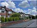
Homes in SK7 6BS are predominantly houses, driving a market characterised by owner occupancy. The home ownership percentage reaches 91%, which is substantially higher than the national average. This statistic confirms the area as a primarily owner-occupied zone rather than a hub for the private rental sector. The accommodation type data shows a landscape filled with properties built for permanent residence and family establishment. When you look at homes in this postcode, you will find that the majority have been passed down or purchased by owners rather than landlords seeking short-term tenants. This high retention of owner-occupied housing suggests a stable market with fewer sudden vacancies. The density of 458 people per square kilometre within a 1.1-hectare boundary implies that space is at a premium. Buyers looking at this area should expect a competitive market where prices are sensitive to supply due to the limited number of plots available. The prevalence of houses over apartments means you can expect gardens and private entrances. This structure supports the lifestyle of families and those seeking space, distinguishing it from high-rise urban developments. ### Digital connectivity in SK7 6BS is robust, supporting modern working and leisure needs without interruption. The fixed broadband quality score of 88 out of 100 indicates an excellent connection for streaming, video calls, and remote work. Similarly, the mobile network quality score of 85 out of 100 provides good coverage across most of the postcode. These figures ensure that working from home in SK7 6BS is reliable, with fast download speeds and minimal buffering. For residents who commute digitally, the area offers the technical infrastructure required for seamless operation. While there are no underground lines directly through this specific 1.1-hectare cluster, nearby stations provide vital links. Hazel Grove Railway Station, Middlewood Railway Station, and Poynton Railway Station are within easy reach, facilitating travel into Manchester and beyond. You can access major motorways and transit hubs like East Didsbury, Peel Hall, and Shadowmoss via nearby metro stops. The strong digital scores mean you do not need to rely solely on physical transport for your daily routine. Reliance on high-speed internet is minimal here, as connectivity matches the reliability of national standards. ### Residents of SK7 6BS benefit from a convenient network of amenities within practical reach. Local retail options include Tesco Hazel, Spar, and Asda Hazel, providing access to supermarkets and essentials without needing to travel far. Once in the area, there are five notable retail venues nearby, covering everything from groceries to household supplies. For commuters, rail connectivity is strong with five nearby stations including Hazel Grove Railway Station and Poynton Railway Station. These transport nodes link you to the wider Manchester convergence. There is also one airport, Manchester Woodford Airport, which serves as a practical aviation resource within the network. Public metro links are available at East Didsbury, Peel Hall, and Shadowmoss, offering further flexibility for daily trips. Living in SK7 6BS means you can walk to basic shops or take a quick train ride for broader city access. The proximity of Asda Hazel and the railway stations simplifies the morning routine significantly. You will find that the combination of local stores and transit points creates a balanced lifestyle where you do not need to drive for most errands. ### Safety and environmental factors in SK7 6BS present a mix of secure conditions and serious criminal concerns. The area passes assessments for flood risk, Ramsar wetland sites, Areas of Outstanding Natural Beauty, protected nature reserves, and protected woodland, all scoring zero on the risk scale. These findings indicate no mandatory planning constraints from environmental agencies for buildings in this postcode. However, the crime risk assessment shows a critical level, with a safety score of 0 out of 100. This low score signifies high crime risk, meaning crime rates are above average compared to other suburban areas. Residents must remain vigilant, and enhanced security measures are recommended to protect property and persons. The contrast between the lack of environmental hazards and the high crime risk is distinct here. While you do not face flooding or protected nature restrictions, you must account for increased security when spending time outdoors or securing vehicles. The safety score of 0 demands that new buyers consider robust locking systems and neighbourhood watch participation. This assessment is a stark reality for anyone planning to live in SK7 6BS. ### Who typically lives in SK7 6BS?The demographic profile shows a median age of 47 years, with adults aged 30 to 64 being the most common group. Home ownership stands at 91%, indicating a stable, owner-occupied community. The population consists of 1,581 people across 1.1 hectares, creating a dense, established neighbourhood where long-term residents dominate the housing stock. What transport links serve SK7 6BS?Digital connectivity is excellent, with a fixed broadband quality score of 88 and a mobile network quality score of 85. Physical transport is accessed through nearby Hazel Grove, Middlewood, and Poynton Railway Stations, plus metro stops at East Didsbury, Peel Hall, and Shadowmoss. Manchester Woodford Airport is also within practical reach, ensuring strong multi-modal connectivity. Is SK7 6BS safe for a family?Environmental safety is high, with zero risk scores for flood, woodland, and protected sites. However, the crime risk assessment is critical, scoring 0 out of 100, which indicates crime rates are above average. Residents are advised to take enhanced security measures to mitigate these specific risks while enjoying the absence of environmental hazards. What shops and amenities are nearby?Five retail venues including Tesco Hazel, Spar, and Asda Hazel provide local shopping. You have access to five railway stations and five metro stops within commuting distance. These amenities ensure that daily essentials and travel requirements are met without leaving the immediate vicinity of the postcode.
House Prices in SK7 6BS
Showing 30 properties
| Address | Type | Beds | Baths | Last Sale Price | Last Sale Date | |
|---|---|---|---|---|---|---|
| 9 Alderley Close, Hazel Grove, Stockport, SK7 6BS | Semi-detached | 3 | 1 | £320,000 | Feb 2023 | |
| 7 Alderley Close, Hazel Grove, Stockport, SK7 6BS | house | 3 | 2 | £456,000 | Apr 2022 | |
| 23 Alderley Close, Hazel Grove, Stockport, SK7 6BS | house | 3 | 1 | £285,000 | Jan 2022 | |
| 5 Alderley Close, Hazel Grove, Stockport, SK7 6BS | Semi-detached | 3 | 1 | £375,000 | Jul 2020 | |
| 30 Alderley Close, Hazel Grove, Stockport, SK7 6BS | Semi-detached | 3 | 1 | £287,000 | Mar 2020 | |
| 4 Alderley Close, Hazel Grove, Stockport, SK7 6BS | Semi-detached | 4 | - | £362,000 | Oct 2019 | |
| 2 Alderley Close, Hazel Grove, Stockport, SK7 6BS | Semi-detached | 5 | 1 | £370,000 | Sep 2018 | |
| 8 Alderley Close, Hazel Grove, Stockport, SK7 6BS | house | - | - | £285,000 | Nov 2017 | |
| 18 Alderley Close, Hazel Grove, Stockport, SK7 6BS | house | - | - | £265,000 | Mar 2017 | |
| 12 Alderley Close, Hazel Grove, Stockport, SK7 6BS | Semi-detached | 3 | - | £227,000 | Oct 2015 |
Energy Efficiency in SK7 6BS
Residents of SK7 6BS benefit from a convenient network of amenities within practical reach. Local retail options include Tesco Hazel, Spar, and Asda Hazel, providing access to supermarkets and essentials without needing to travel far. Once in the area, there are five notable retail venues nearby, covering everything from groceries to household supplies. For commuters, rail connectivity is strong with five nearby stations including Hazel Grove Railway Station and Poynton Railway Station. These transport nodes link you to the wider Manchester convergence. There is also one airport, Manchester Woodford Airport, which serves as a practical aviation resource within the network. Public metro links are available at East Didsbury, Peel Hall, and Shadowmoss, offering further flexibility for daily trips. Living in SK7 6BS means you can walk to basic shops or take a quick train ride for broader city access. The proximity of Asda Hazel and the railway stations simplifies the morning routine significantly. You will find that the combination of local stores and transit points creates a balanced lifestyle where you do not need to drive for most errands. ### Safety and environmental factors in SK7 6BS present a mix of secure conditions and serious criminal concerns. The area passes assessments for flood risk, Ramsar wetland sites, Areas of Outstanding Natural Beauty, protected nature reserves, and protected woodland, all scoring zero on the risk scale. These findings indicate no mandatory planning constraints from environmental agencies for buildings in this postcode. However, the crime risk assessment shows a critical level, with a safety score of 0 out of 100. This low score signifies high crime risk, meaning crime rates are above average compared to other suburban areas. Residents must remain vigilant, and enhanced security measures are recommended to protect property and persons. The contrast between the lack of environmental hazards and the high crime risk is distinct here. While you do not face flooding or protected nature restrictions, you must account for increased security when spending time outdoors or securing vehicles. The safety score of 0 demands that new buyers consider robust locking systems and neighbourhood watch participation. This assessment is a stark reality for anyone planning to live in SK7 6BS. ### Who typically lives in SK7 6BS?The demographic profile shows a median age of 47 years, with adults aged 30 to 64 being the most common group. Home ownership stands at 91%, indicating a stable, owner-occupied community. The population consists of 1,581 people across 1.1 hectares, creating a dense, established neighbourhood where long-term residents dominate the housing stock. What transport links serve SK7 6BS?Digital connectivity is excellent, with a fixed broadband quality score of 88 and a mobile network quality score of 85. Physical transport is accessed through nearby Hazel Grove, Middlewood, and Poynton Railway Stations, plus metro stops at East Didsbury, Peel Hall, and Shadowmoss. Manchester Woodford Airport is also within practical reach, ensuring strong multi-modal connectivity. Is SK7 6BS safe for a family?Environmental safety is high, with zero risk scores for flood, woodland, and protected sites. However, the crime risk assessment is critical, scoring 0 out of 100, which indicates crime rates are above average. Residents are advised to take enhanced security measures to mitigate these specific risks while enjoying the absence of environmental hazards. What shops and amenities are nearby?Five retail venues including Tesco Hazel, Spar, and Asda Hazel provide local shopping. You have access to five railway stations and five metro stops within commuting distance. These amenities ensure that daily essentials and travel requirements are met without leaving the immediate vicinity of the postcode.
Amenities
Schools
| Rank | School | Type | Entry gender | Ages |
|---|
Explore more schools in this area
Go to Schools tabDemographics
The community in SK7 6BS reflects a mature demographic profile with a median age of 47 years. Adults aged between 30 and 64 years form the most common age range, suggesting a population in the prime working years. Home ownership levels are exceptionally high at 91%, meaning nearly every household in this postcode owns their property outright or with a mortgage. This significant majority of owners shapes the social fabric of the area, as residents here have a long-term stake in the locality. The accommodation type is exclusively houses, which aligns with the higher home ownership rate and the preference for dedicated outdoor space. The predominant ethnic group is White, which defines the current cultural composition of the neighbourhood. With a population of 1,581 people, the social interactions are frequent and direct. The high rate of home ownership in this specific cluster indicates financial stability among the residents. You are likely to encounter a community where property investment is common and transient rental populations are rare. This demographic stability means that those living in SK7 6BS are likely to invest in long-term improvements to their properties. ### Homes in SK7 6BS are predominantly houses, driving a market characterised by owner occupancy. The home ownership percentage reaches 91%, which is substantially higher than the national average. This statistic confirms the area as a primarily owner-occupied zone rather than a hub for the private rental sector. The accommodation type data shows a landscape filled with properties built for permanent residence and family establishment. When you look at homes in this postcode, you will find that the majority have been passed down or purchased by owners rather than landlords seeking short-term tenants. This high retention of owner-occupied housing suggests a stable market with fewer sudden vacancies. The density of 458 people per square kilometre within a 1.1-hectare boundary implies that space is at a premium. Buyers looking at this area should expect a competitive market where prices are sensitive to supply due to the limited number of plots available. The prevalence of houses over apartments means you can expect gardens and private entrances. This structure supports the lifestyle of families and those seeking space, distinguishing it from high-rise urban developments. ### Digital connectivity in SK7 6BS is robust, supporting modern working and leisure needs without interruption. The fixed broadband quality score of 88 out of 100 indicates an excellent connection for streaming, video calls, and remote work. Similarly, the mobile network quality score of 85 out of 100 provides good coverage across most of the postcode. These figures ensure that working from home in SK7 6BS is reliable, with fast download speeds and minimal buffering. For residents who commute digitally, the area offers the technical infrastructure required for seamless operation. While there are no underground lines directly through this specific 1.1-hectare cluster, nearby stations provide vital links. Hazel Grove Railway Station, Middlewood Railway Station, and Poynton Railway Station are within easy reach, facilitating travel into Manchester and beyond. You can access major motorways and transit hubs like East Didsbury, Peel Hall, and Shadowmoss via nearby metro stops. The strong digital scores mean you do not need to rely solely on physical transport for your daily routine. Reliance on high-speed internet is minimal here, as connectivity matches the reliability of national standards. ### Residents of SK7 6BS benefit from a convenient network of amenities within practical reach. Local retail options include Tesco Hazel, Spar, and Asda Hazel, providing access to supermarkets and essentials without needing to travel far. Once in the area, there are five notable retail venues nearby, covering everything from groceries to household supplies. For commuters, rail connectivity is strong with five nearby stations including Hazel Grove Railway Station and Poynton Railway Station. These transport nodes link you to the wider Manchester convergence. There is also one airport, Manchester Woodford Airport, which serves as a practical aviation resource within the network. Public metro links are available at East Didsbury, Peel Hall, and Shadowmoss, offering further flexibility for daily trips. Living in SK7 6BS means you can walk to basic shops or take a quick train ride for broader city access. The proximity of Asda Hazel and the railway stations simplifies the morning routine significantly. You will find that the combination of local stores and transit points creates a balanced lifestyle where you do not need to drive for most errands. ### Safety and environmental factors in SK7 6BS present a mix of secure conditions and serious criminal concerns. The area passes assessments for flood risk, Ramsar wetland sites, Areas of Outstanding Natural Beauty, protected nature reserves, and protected woodland, all scoring zero on the risk scale. These findings indicate no mandatory planning constraints from environmental agencies for buildings in this postcode. However, the crime risk assessment shows a critical level, with a safety score of 0 out of 100. This low score signifies high crime risk, meaning crime rates are above average compared to other suburban areas. Residents must remain vigilant, and enhanced security measures are recommended to protect property and persons. The contrast between the lack of environmental hazards and the high crime risk is distinct here. While you do not face flooding or protected nature restrictions, you must account for increased security when spending time outdoors or securing vehicles. The safety score of 0 demands that new buyers consider robust locking systems and neighbourhood watch participation. This assessment is a stark reality for anyone planning to live in SK7 6BS. ### Who typically lives in SK7 6BS?The demographic profile shows a median age of 47 years, with adults aged 30 to 64 being the most common group. Home ownership stands at 91%, indicating a stable, owner-occupied community. The population consists of 1,581 people across 1.1 hectares, creating a dense, established neighbourhood where long-term residents dominate the housing stock. What transport links serve SK7 6BS?Digital connectivity is excellent, with a fixed broadband quality score of 88 and a mobile network quality score of 85. Physical transport is accessed through nearby Hazel Grove, Middlewood, and Poynton Railway Stations, plus metro stops at East Didsbury, Peel Hall, and Shadowmoss. Manchester Woodford Airport is also within practical reach, ensuring strong multi-modal connectivity. Is SK7 6BS safe for a family?Environmental safety is high, with zero risk scores for flood, woodland, and protected sites. However, the crime risk assessment is critical, scoring 0 out of 100, which indicates crime rates are above average. Residents are advised to take enhanced security measures to mitigate these specific risks while enjoying the absence of environmental hazards. What shops and amenities are nearby?Five retail venues including Tesco Hazel, Spar, and Asda Hazel provide local shopping. You have access to five railway stations and five metro stops within commuting distance. These amenities ensure that daily essentials and travel requirements are met without leaving the immediate vicinity of the postcode.
Household Size
Accommodation Type
Tenure
Ethnic Group
Religion
Household Composition
Age
Household Deprivation
NS-SEC
Explore more demographic insights in this area
Go to Demographics tabPlanning
Planning Constraints
- Flood RiskPremium
- Ramsar Wetland SitesPremium
- Area of Outstanding Natural BeautyPremium
- Protected Nature ReservePremium
- Protected WoodlandPremium