Area Overview for SK7 5PF
Photos of SK7 5PF
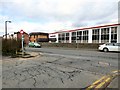

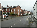
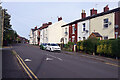

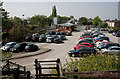

36 photos from this area
Area Information
Key information about the SK7 5PF including its size, population, and administrative classification.
- Area Type
- Postcode
- Area Size
- 1.4 hectares
- Population
- 1436
- Population Density
- 4256 people/km²
House Prices in SK7 5PF
25
Properties
£191,866
Average Sold Price
£76,950
Lowest Price
£308,800
Highest Price
Showing 25 properties
| Address | Type | Beds | Baths | Last Sale Price | Last Sale Date | |
|---|---|---|---|---|---|---|
| 12 Longmead Avenue, Hazel Grove, Stockport, SK7 5PF | Semi-detached | 2 | 1 | £280,000 | Oct 2024 | |
| 4 Longmead Avenue, Hazel Grove, Stockport, SK7 5PF | Semi-detached | 2 | 1 | £308,800 | Jul 2024 | |
| 24 Longmead Avenue, Hazel Grove, Stockport, SK7 5PF | Detached | 2 | 1 | £249,999 | Aug 2022 | |
| 2 Longmead Avenue, Hazel Grove, Stockport, SK7 5PF | Semi-detached | 2 | 1 | £299,000 | Mar 2022 | |
| 14 Longmead Avenue, Hazel Grove, Stockport, SK7 5PF | house | - | - | £261,000 | Feb 2022 | |
| 18 Longmead Avenue, Hazel Grove, Stockport, SK7 5PF | house | - | - | £258,000 | Sep 2021 | |
| 46 Longmead Avenue, Hazel Grove, Stockport, SK7 5PF | house | - | - | £220,000 | Nov 2020 | |
| 16 Longmead Avenue, Hazel Grove, Stockport, SK7 5PF | house | - | - | £182,075 | Jul 2018 | |
| 32 Longmead Avenue, Hazel Grove, Stockport, SK7 5PF | house | - | - | £195,000 | Mar 2018 | |
| 28 Longmead Avenue, Hazel Grove, Stockport, SK7 5PF | house | 2 | - | £200,000 | Jan 2017 |
Page 1 of 3
Energy Efficiency in SK7 5PF
Amenities
Schools
| Rank | School | Type | Entry gender | Ages |
|---|
Explore more schools in this area
Go to Schools tabDemographics
Household Size
Family (3-5 people)
most common
Accommodation Type
Houses
most common
Tenure
93
majority
Ethnic Group
White
most common
Religion
N/A
most common
Household Composition
N/A
most common
Age
47
median
Adults (30-64 years)
most common
Household Deprivation
N/A
with no deprivation
NS-SEC
43
in Lower managerial occupations
Explore more demographic insights in this area
Go to Demographics tabPlanning
Planning Constraints
- Flood RiskPremium
- Ramsar Wetland SitesPremium
- Area of Outstanding Natural BeautyPremium
- Protected Nature ReservePremium
- Protected WoodlandPremium