Area Overview for SK7 5HU
Photos of SK7 5HU
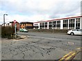

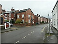
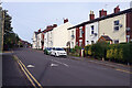

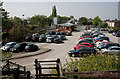

36 photos from this area
Area Information
Key information about the SK7 5HU including its size, population, and administrative classification.
- Area Type
- Postcode
- Area Size
- 2.0 hectares
- Population
- 1296
- Population Density
- 3251 people/km²
House Prices in SK7 5HU
35
Properties
£221,289
Average Sold Price
£69,000
Lowest Price
£480,000
Highest Price
Showing 35 properties
| Address | Type | Beds | Baths | Last Sale Price | Last Sale Date | |
|---|---|---|---|---|---|---|
| 72 Aldwyn Crescent, Hazel Grove, Stockport, SK7 5HU | Semi-detached | 5 | 3 | £480,000 | Aug 2024 | |
| 56 Aldwyn Crescent, Hazel Grove, Stockport, SK7 5HU | house | - | - | £370,000 | Aug 2022 | |
| 64 Aldwyn Crescent, Hazel Grove, Stockport, SK7 5HU | house | - | - | £276,000 | Feb 2021 | |
| 43 Aldwyn Crescent, Hazel Grove, Stockport, SK7 5HU | house | - | - | £311,000 | Feb 2021 | |
| 23 Aldwyn Crescent, Hazel Grove, Stockport, SK7 5HU | Semi-detached | 3 | 1 | £286,500 | Jul 2020 | |
| 74 Aldwyn Crescent, Hazel Grove, Stockport, SK7 5HU | Semi-detached | 3 | 1 | £275,000 | Jun 2020 | |
| 70 Aldwyn Crescent, Hazel Grove, Stockport, SK7 5HU | Semi-detached | 4 | 2 | £330,000 | Nov 2019 | |
| 54 Aldwyn Crescent, Hazel Grove, Stockport, SK7 5HU | house | - | - | £197,000 | Dec 2012 | |
| 35 Aldwyn Crescent, Hazel Grove, Stockport, SK7 5HU | house | - | - | £287,500 | Apr 2012 | |
| 40 Aldwyn Crescent, Hazel Grove, Stockport, SK7 5HU | Bungalow | - | - | £235,000 | Jul 2011 |
Page 1 of 4
Energy Efficiency in SK7 5HU
Amenities
Schools
| Rank | School | Type | Entry gender | Ages |
|---|
Explore more schools in this area
Go to Schools tabDemographics
Household Size
Family (3-5 people)
most common
Accommodation Type
Houses
most common
Tenure
97
majority
Ethnic Group
White
most common
Religion
N/A
most common
Household Composition
N/A
most common
Age
47
median
Adults (30-64 years)
most common
Household Deprivation
N/A
with no deprivation
NS-SEC
43
in Lower managerial occupations
Explore more demographic insights in this area
Go to Demographics tabPlanning
Planning Constraints
- Flood RiskPremium
- Ramsar Wetland SitesPremium
- Area of Outstanding Natural BeautyPremium
- Protected Nature ReservePremium
- Protected WoodlandPremium