Area Overview for SK7 5HR
Photos of SK7 5HR
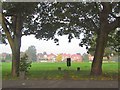


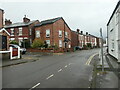
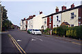


36 photos from this area
Area Information
Key information about the SK7 5HR including its size, population, and administrative classification.
- Area Type
- Postcode
- Area Size
- 1.4 hectares
- Population
- 1296
- Population Density
- 3251 people/km²
House Prices in SK7 5HR
22
Properties
£278,247
Average Sold Price
£580
Lowest Price
£497,000
Highest Price
Showing 22 properties
| Address | Type | Beds | Baths | Last Sale Price | Last Sale Date | |
|---|---|---|---|---|---|---|
| 33 Mostyn Road, Hazel Grove, Stockport, SK7 5HR | Bungalow | 4 | 3 | £497,000 | Apr 2024 | |
| 29 Mostyn Road, Hazel Grove, Stockport, SK7 5HR | Bungalow | - | - | £395,000 | Jun 2021 | |
| 25 Mostyn Road, Hazel Grove, Stockport, SK7 5HR | Bungalow | - | - | £350,000 | Apr 2021 | |
| 43 Mostyn Road, Hazel Grove, Stockport, SK7 5HR | Bungalow | - | - | £465,000 | Apr 2021 | |
| 41 Mostyn Road, Hazel Grove, Stockport, SK7 5HR | Bungalow | 4 | 1 | £580 | Feb 2021 | |
| 28 Mostyn Road, Hazel Grove, Stockport, SK7 5HR | Detached | - | - | £670 | Jun 2019 | |
| 39 Mostyn Road, Hazel Grove, Stockport, SK7 5HR | Bungalow | - | - | £330,000 | Sep 2017 | |
| 26 Mostyn Road, Hazel Grove, Stockport, SK7 5HR | Detached | 3 | - | £390,000 | Oct 2015 | |
| 27 Mostyn Road, Hazel Grove, Stockport, SK7 5HR | Bungalow | - | - | £295,000 | Mar 2014 | |
| 34 Mostyn Road, Hazel Grove, Stockport, SK7 5HR | Detached | 4 | 2 | £310,000 | Jun 2012 |
Page 1 of 3
Energy Efficiency in SK7 5HR
Amenities
Schools
| Rank | School | Type | Entry gender | Ages |
|---|
Explore more schools in this area
Go to Schools tabDemographics
Household Size
Family (3-5 people)
most common
Accommodation Type
Houses
most common
Tenure
97
majority
Ethnic Group
White
most common
Religion
N/A
most common
Household Composition
N/A
most common
Age
47
median
Adults (30-64 years)
most common
Household Deprivation
N/A
with no deprivation
NS-SEC
43
in Lower managerial occupations
Explore more demographic insights in this area
Go to Demographics tabPlanning
Planning Constraints
- Flood RiskPremium
- Ramsar Wetland SitesPremium
- Area of Outstanding Natural BeautyPremium
- Protected Nature ReservePremium
- Protected WoodlandPremium