Area Overview for SK7 5EL
Photos of SK7 5EL


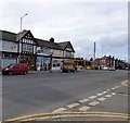
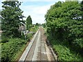


32 photos from this area
Area Information
Key information about the SK7 5EL including its size, population, and administrative classification.
- Area Type
- Postcode
- Area Size
- 5.1 hectares
- Population
- 2219
- Population Density
- 2838 people/km²
House Prices in SK7 5EL
39
Properties
£300,012
Average Sold Price
£80,000
Lowest Price
£570,000
Highest Price
Showing 39 properties
| Address | Type | Beds | Baths | Last Sale Price | Last Sale Date | |
|---|---|---|---|---|---|---|
| 37 Blackthorn Road, Hazel Grove, Stockport, SK7 5EL | house | - | - | £140,550 | Feb 2025 | |
| 45 Blackthorn Road, Hazel Grove, Stockport, SK7 5EL | house | - | - | £339,950 | Nov 2024 | |
| 23 Blackthorn Road, Hazel Grove, Stockport, SK7 5EL | Detached | 5 | 2 | £570,000 | Oct 2023 | |
| 27 Blackthorn Road, Hazel Grove, Stockport, SK7 5EL | Detached | 3 | 2 | £405,000 | Sep 2023 | |
| 67 Blackthorn Road, Hazel Grove, Stockport, SK7 5EL | house | - | - | £500,000 | May 2023 | |
| 21 Blackthorn Road, Hazel Grove, Stockport, SK7 5EL | Detached | 5 | 3 | £499,500 | Dec 2022 | |
| 63 Blackthorn Road, Hazel Grove, Stockport, SK7 5EL | Semi-detached | 3 | 2 | £366,000 | May 2022 | |
| 33 Blackthorn Road, Hazel Grove, Stockport, SK7 5EL | house | - | - | £138,750 | May 2022 | |
| 53 Blackthorn Road, Hazel Grove, Stockport, SK7 5EL | Detached | 4 | 1 | £454,100 | Jun 2021 | |
| 19 Blackthorn Road, Hazel Grove, Stockport, SK7 5EL | house | - | - | £450,000 | Feb 2021 |
Page 1 of 4
Energy Efficiency in SK7 5EL
Amenities
Schools
| Rank | School | Type | Entry gender | Ages |
|---|
Explore more schools in this area
Go to Schools tabDemographics
Household Size
Family (3-5 people)
most common
Accommodation Type
Houses
most common
Tenure
76
majority
Ethnic Group
White
most common
Religion
N/A
most common
Household Composition
N/A
most common
Age
47
median
Adults (30-64 years)
most common
Household Deprivation
N/A
with no deprivation
NS-SEC
42
in Lower managerial occupations
Explore more demographic insights in this area
Go to Demographics tabPlanning
Planning Constraints
- Flood RiskPremium
- Ramsar Wetland SitesPremium
- Area of Outstanding Natural BeautyPremium
- Protected Nature ReservePremium
- Protected WoodlandPremium