Area Overview for SK7 4QY
Photos of SK7 4QY

Area Information
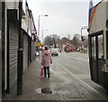
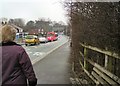
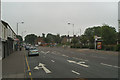
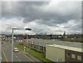
Living in SK7 4QY defines a specific residential cluster within England, characterised by a tightly knit community of 1,833 residents. This area represents a focused neighbourhood where daily life revolves around established housing stock and local infrastructure. The population density here is modest compared to larger urban centres, yet the concentration of homes creates a sense of proximity among neighbours. Most residents live in houses, which suggests a preference for standing property over flats or apartments in this postcode cluster. The environment is not defined by massive commercial hubs or industrial zones, but rather by the quiet rhythm of domestic life punctuated by access to nearby services. You are looking at a settled environment where long-term residents tend to remain within the same location. The area serves as a residential pocket that benefits from its proximity to Hazel Grove and surrounding transport links without being overwhelmed by heavy traffic. When you consider a home here, you are entering an area with a clear identity as a housing zone rather than a mixed-use district. The small population size means that local issues, such as noise or maintenance, can be managed more directly than in sprawling suburbs. Your daily commute and leisure activities will depend heavily on the connectivity provided by rail and digital networks, making the location strategic rather than self-contained. The distinctiveness of SK7 4QY lies in its residential purity and its direct links to the wider transport network serving the region.
- Area Type
- Postcode
- Area Size
- Not available
- Population
- 1833
- Population Density
- 3134 people/km²
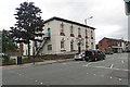
The housing market within SK7 4QY is defined by a strong predominance of private ownership. With 79 per cent of homes owned by their occupants, this postcode operates more like a settled residential district than a high-turnover rental block. The accommodation type available is almost exclusively houses, which means you will not find flats or purpose-built apartments in this specific cluster. This housing stock typically appeals to families or couples seeking space and privacy rather than the compact living found in urban apartments. When you look at the market here, you are entering a space where properties have likely been held for significant periods, reducing the number of quick sales driven by short-term landlords. The small population of 1,833 people limits the volume of active listings at any one time, meaning the market moves with a certain deliberation. Buyers in this area are often looking for the opportunity to acquire a house within a well-defined neighbourhood rather than navigating a large, anonymous estate agent listing. The fact that the majority of residents are owners implants a value on property maintenance and enhancements, which can protect the character of the streets. If you are looking to buy, you are likely competing with other owner-occupiers rather than institutional investors. This dynamic supports a stable market where price is driven by local demand and the limited supply of available houses. The data confirms that this is an area where staying power is the norm, not the exception.
House Prices in SK7 4QY
No properties found in this postcode.
Energy Efficiency in SK7 4QY
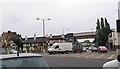
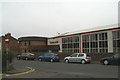
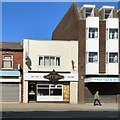
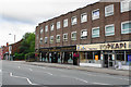
Daily life in SK7 4QY is supported by a cluster of amenities that are within practical reach for families and shoppers. You have access to five retail outlets nearby, including Asda Hazel, M&S Hazel Grove SF, and Aldi Hazel. These supermarkets provide all the essentials you need for food shopping, household goods, and larger items without requiring a long journey. For leisure and transport connections, you are close to Hazel Grove Railway Station and nearby hubs like Woodsmoor and Davenport. Travel enthusiasts might utilise the proximity to Manchester Woodford Airport, which is the only airport listed in this immediate catchment area. Beyond shops and trains, there are five metropolitan locations nearby such as East Didsbury, Didsbury Village, and Peel Hall, offering cultural dining and further retail options for weekend trips. This mix of local essentials and nearby hubs means you do not need to drive far for routine errands, yet you have variety when you wish to explore. The combination of a local supermarket and railway access creates a convenient lifestyle where work, life, and leisure are easily balanced. You can plan your week around the opening hours of Asda and the train schedules to and from Hazel Grove. This practical arrangement ensures that living in this postcode does not sacrifice convenience for quietness, as your essential services are located in dedicated retail parks close by.
Amenities
Schools
Families considering a move to SK7 4QY must plan carefully regarding school placements, as the immediate vicinity offers a specific educational option for younger children. The nearest educational facility is St Simon's Catholic Primary School, which has achieved a good Ofsted rating. This school serves the primary education needs for children in the age range required for primary schooling. There are no secondary schools or high schools listed in the immediate data for this postcode, which means that older students would need to travel further for secondary education. The presence of one primary school with a positive rating suggests that the local community supports early childhood education well. If you have a young child, you have access to a school that meets government quality standards for teaching and care. The mix of school types available is limited, so your decisions about housing will depend heavily on whether you have children likely to need primary education in the near future. Commuters or older families might not rely on local schools at all, as the area is clear of secondary institutions in the list. You must therefore factor in transport costs or travel time if you need to reach secondary schools outside the immediate neighbourhood. The good rating of St Simon's is a positive practical fact that removes anxiety about the quality of primary education available to a resident in this postcode.
| Rank | School | Type | Entry gender | Ages |
|---|
Explore more schools in this area
Go to Schools tabDemographics
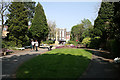
The community profile of SK7 4QY reflects a mature and stable demographic, with a median age of 47 years. Most residents fall into the age bracket of adults between 30 and 64 years, indicating a population that has likely already established families or careers. This age range typically correlates with a need for practical housing solutions rather than purpose-built student accommodation or retirement-specific developments. You will find that 79 per cent of households in this area own their homes outright or are in the process of paying off a mortgage. This high ownership rate signifies a lack of student transient population and a community where residents are invested in the long-term stability of their immediate surroundings. The diversity of the population is largely defined by the White ethnic group, which forms the predominant demographic. You are looking at a cohesive group of occupants who have chosen to settle in this postcode. There is little evidence in the available records of a transient rental market dominating the streets. Instead, the demographic makeup points towards a neighbourhood where people buy to stay. This stability often translates to well-maintained gardens and neighbourhood watches that operate effectively because owners have a vested interest in their property values. The age profile also suggests that this is not a area for young families looking for temporary housing, but rather a place where children grow up as parents remain in the community throughout their child-rearing years.
Household Size
Accommodation Type
Tenure
Ethnic Group
Religion
Household Composition
Age
Household Deprivation
NS-SEC
Explore more demographic insights in this area
Go to Demographics tabPlanning
Planning Constraints
- Flood RiskPremium
- Ramsar Wetland SitesPremium
- Area of Outstanding Natural BeautyPremium
- Protected Nature ReservePremium
- Protected WoodlandPremium