Area Overview for SK7 4QL
Photos of SK7 4QL
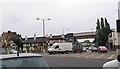
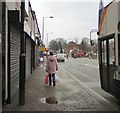
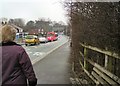
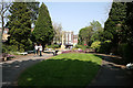
92 photos from this area
Area Information
Key information about the SK7 4QL including its size, population, and administrative classification.
- Area Type
- Postcode
- Area Size
- 8594 m²
- Population
- 1833
- Population Density
- 3134 people/km²
House Prices in SK7 4QL
14
Properties
£260,340
Average Sold Price
£80,500
Lowest Price
£368,000
Highest Price
Showing 14 properties
| Address | Type | Beds | Baths | Last Sale Price | Last Sale Date | |
|---|---|---|---|---|---|---|
| 123 Hazelwood Road, Hazel Grove, Stockport, SK7 4QL | Bungalow | 2 | 1 | £315,000 | Jan 2024 | |
| 116 Hazelwood Road, Hazel Grove, Stockport, SK7 4QL | Bungalow | 2 | 1 | £368,000 | May 2022 | |
| 127 Hazelwood Road, Hazel Grove, Stockport, SK7 4QL | Bungalow | 2 | 1 | £280,000 | Feb 2022 | |
| 115 Hazelwood Road, Hazel Grove, Stockport, SK7 4QL | Bungalow | 2 | 1 | £240,000 | Dec 2018 | |
| 119 Hazelwood Road, Hazel Grove, Stockport, SK7 4QL | Bungalow | - | - | £299,950 | Oct 2014 | |
| 118 Hazelwood Road, Hazel Grove, Stockport, SK7 4QL | Bungalow | - | - | £240,000 | Apr 2014 | |
| 111 Hazelwood Road, Hazel Grove, Stockport, SK7 4QL | Bungalow | 3 | - | £225,000 | Nov 2011 | |
| 121 Hazelwood Road, Hazel Grove, Stockport, SK7 4QL | Bungalow | - | - | £269,950 | Aug 2010 | |
| 120 Hazelwood Road, Hazel Grove, Stockport, SK7 4QL | Bungalow | 3 | 1 | £285,000 | Feb 2005 | |
| 114 Hazelwood Road, Hazel Grove, Stockport, SK7 4QL | Detached | - | - | £80,500 | Jun 1996 |
Page 1 of 2
Energy Efficiency in SK7 4QL
Amenities
Schools
| Rank | School | Type | Entry gender | Ages |
|---|
Explore more schools in this area
Go to Schools tabDemographics
Household Size
Two person
most common
Accommodation Type
Houses
most common
Tenure
79
majority
Ethnic Group
White
most common
Religion
N/A
most common
Household Composition
N/A
most common
Age
47
median
Adults (30-64 years)
most common
Household Deprivation
N/A
with no deprivation
NS-SEC
38
in Lower managerial occupations
Explore more demographic insights in this area
Go to Demographics tabPlanning
Planning Constraints
- Flood RiskPremium
- Ramsar Wetland SitesPremium
- Area of Outstanding Natural BeautyPremium
- Protected Nature ReservePremium
- Protected WoodlandPremium