Area Overview for SK7 4QG
Photos of SK7 4QG

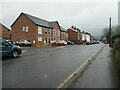
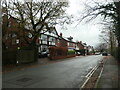
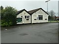
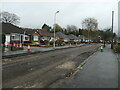
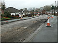
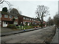
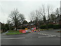
38 photos from this area
Area Information
Key information about the SK7 4QG including its size, population, and administrative classification.
- Area Type
- Postcode
- Area Size
- 1.9 hectares
- Population
- 1833
- Population Density
- 3134 people/km²
House Prices in SK7 4QG
38
Properties
£221,515
Average Sold Price
£73,000
Lowest Price
£372,500
Highest Price
Showing 38 properties
| Address | Type | Beds | Baths | Last Sale Price | Last Sale Date | |
|---|---|---|---|---|---|---|
| 29 Braemar Road, Hazel Grove, Stockport, SK7 4QG | Bungalow | 2 | 1 | £310,000 | Feb 2024 | |
| 8 Braemar Road, Hazel Grove, Stockport, SK7 4QG | house | - | - | £350,000 | Nov 2023 | |
| 36 Braemar Road, Hazel Grove, Stockport, SK7 4QG | Retail | 2 | 1 | £360,000 | Oct 2022 | |
| 3 Braemar Road, Hazel Grove, Stockport, SK7 4QG | Semi-detached | 3 | 1 | £305,000 | Apr 2022 | |
| 25 Braemar Road, Hazel Grove, Stockport, SK7 4QG | Detached | 2 | - | £330,000 | May 2021 | |
| 41 Braemar Road, Hazel Grove, Stockport, SK7 4QG | Bungalow | - | - | £355,000 | Feb 2021 | |
| 18 Braemar Road, Hazel Grove, Stockport, SK7 4QG | Semi-detached | 3 | 1 | £250,000 | Apr 2018 | |
| 21 Braemar Road, Hazel Grove, Stockport, SK7 4QG | Bungalow | 3 | 1 | £372,500 | Jul 2017 | |
| 5 Braemar Road, Hazel Grove, Stockport, SK7 4QG | Semi-detached | 3 | 1 | £200,000 | Aug 2016 | |
| 33 Braemar Road, Hazel Grove, Stockport, SK7 4QG | Bungalow | - | - | £245,000 | Jul 2016 |
Page 1 of 4
Energy Efficiency in SK7 4QG
Amenities
Schools
| Rank | School | Type | Entry gender | Ages |
|---|
Explore more schools in this area
Go to Schools tabDemographics
Household Size
Two person
most common
Accommodation Type
Houses
most common
Tenure
79
majority
Ethnic Group
White
most common
Religion
N/A
most common
Household Composition
N/A
most common
Age
47
median
Adults (30-64 years)
most common
Household Deprivation
N/A
with no deprivation
NS-SEC
38
in Lower managerial occupations
Explore more demographic insights in this area
Go to Demographics tabPlanning
Planning Constraints
- Flood RiskPremium
- Ramsar Wetland SitesPremium
- Area of Outstanding Natural BeautyPremium
- Protected Nature ReservePremium
- Protected WoodlandPremium