Area Overview for SK7 3DL
Photos of SK7 3DL
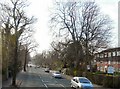
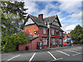

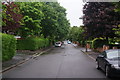
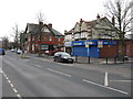
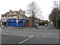
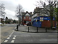
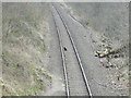
15 photos from this area
Area Information
Key information about the SK7 3DL including its size, population, and administrative classification.
- Area Type
- Postcode
- Area Size
- 1.7 hectares
- Population
- 1300
- Population Density
- 3503 people/km²
House Prices in SK7 3DL
20
Properties
£461,591
Average Sold Price
£118,000
Lowest Price
£790,000
Highest Price
Showing 20 properties
| Address | Type | Beds | Baths | Last Sale Price | Last Sale Date | |
|---|---|---|---|---|---|---|
| 306 Bramhall Lane South, Bramhall, Stockport, SK7 3DL | Semi-detached | 4 | 2 | £757,500 | Jul 2025 | |
| 326 Bramhall Lane South, Bramhall, Stockport, SK7 3DL | Detached | 5 | 3 | £785,000 | Oct 2023 | |
| 318 Bramhall Lane South, Bramhall, Stockport, SK7 3DL | Bungalow | - | - | £790,000 | Aug 2022 | |
| 314 Bramhall Lane South, Bramhall, Stockport, SK7 3DL | house | - | - | £481,000 | Aug 2019 | |
| 310 Bramhall Lane South, Bramhall, Stockport, SK7 3DL | house | - | - | £565,000 | Jan 2019 | |
| 336 Bramhall Lane South, Bramhall, Stockport, SK7 3DL | house | - | - | £510,000 | Jul 2017 | |
| 334 Bramhall Lane South, Bramhall, Stockport, SK7 3DL | Detached | 5 | 2 | £580,000 | Jul 2016 | |
| 332 Bramhall Lane South, Bramhall, Stockport, SK7 3DL | house | 7 | - | £655,000 | Dec 2012 | |
| 302 Bramhall Lane South, Bramhall, Stockport, SK7 3DL | house | 4 | - | £490,000 | Aug 2012 | |
| 322 Bramhall Lane South, Bramhall, Stockport, SK7 3DL | Semi-detached | - | - | £350,000 | Nov 2010 |
Page 1 of 2
Energy Efficiency in SK7 3DL
Amenities
Schools
| Rank | School | Type | Entry gender | Ages |
|---|
Explore more schools in this area
Go to Schools tabDemographics
Household Size
Two person
most common
Accommodation Type
Houses
most common
Tenure
85
majority
Ethnic Group
White
most common
Religion
N/A
most common
Household Composition
N/A
most common
Age
47
median
Adults (30-64 years)
most common
Household Deprivation
N/A
with no deprivation
NS-SEC
46
in Lower managerial occupations
Explore more demographic insights in this area
Go to Demographics tabPlanning
Planning Constraints
- Flood RiskPremium
- Ramsar Wetland SitesPremium
- Area of Outstanding Natural BeautyPremium
- Protected Nature ReservePremium
- Protected WoodlandPremium