Area Overview for SK7 1RD
Photos of SK7 1RD

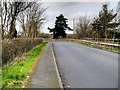
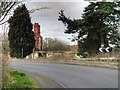
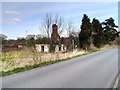
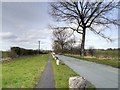


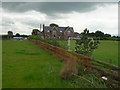
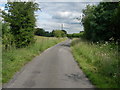
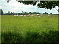
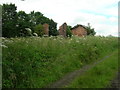
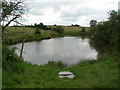
14 photos from this area
Area Information
Key information about the SK7 1RD including its size, population, and administrative classification.
- Area Type
- Postcode
- Area Size
- 15.7 hectares
- Population
- 2242
- Population Density
- 389 people/km²
House Prices in SK7 1RD
19
Properties
£524,636
Average Sold Price
£20,000
Lowest Price
£1,050,000
Highest Price
Showing 19 properties
| Address | Type | Beds | Baths | Last Sale Price | Last Sale Date | |
|---|---|---|---|---|---|---|
| 44 Hall Moss Lane, Woodford, Stockport, SK7 1RD | Detached | 4 | 3 | £805,000 | Feb 2025 | |
| Four Acres, 48 Hall Moss Lane, Woodford, Stockport, SK7 1RD | Detached | 3 | 3 | £1,050,000 | Feb 2023 | |
| Windyridge, 52 Hall Moss Lane, Woodford, Stockport, SK7 1RD | house | - | - | £20,000 | May 2022 | |
| Poynings, 60 Hall Moss Lane, Woodford, Stockport, SK7 1RD | Detached | 4 | 2 | £870,000 | Oct 2020 | |
| 40 Hall Moss Lane, Woodford, Stockport, SK7 1RD | Bungalow | - | - | £285,000 | Nov 2017 | |
| The Gables, 64 Hall Moss Lane, Woodford, Stockport, SK7 1RD | house | 4 | - | £723,000 | Feb 2016 | |
| 50 Hall Moss Lane, Woodford, Stockport, SK7 1RD | Detached | 4 | - | £565,000 | Jan 2015 | |
| Greenoaks, 62 Hall Moss Lane, Woodford, Stockport, SK7 1RD | house | - | - | £475,000 | Jan 2012 | |
| Thornfield, 54 Hall Moss Lane, Woodford, Stockport, SK7 1RD | house | - | - | £580,000 | Feb 2011 | |
| Lamorna, 56 Hall Moss Lane, Woodford, Stockport, SK7 1RD | Semi-detached | 4 | 2 | £293,000 | Dec 2003 |
Page 1 of 2
Energy Efficiency in SK7 1RD
Amenities
Schools
| Rank | School | Type | Entry gender | Ages |
|---|
Explore more schools in this area
Go to Schools tabDemographics
Household Size
Family (3-5 people)
most common
Accommodation Type
Houses
most common
Tenure
91
majority
Ethnic Group
White
most common
Religion
N/A
most common
Household Composition
N/A
most common
Age
47
median
Adults (30-64 years)
most common
Household Deprivation
N/A
with no deprivation
NS-SEC
57
in Lower managerial occupations
Explore more demographic insights in this area
Go to Demographics tabPlanning
Planning Constraints
- Flood RiskPremium
- Ramsar Wetland SitesPremium
- Area of Outstanding Natural BeautyPremium
- Protected Nature ReservePremium
- Protected WoodlandPremium