Area Overview for SK7 1HY
Photos of SK7 1HY
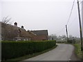
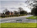
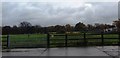
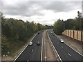
15 photos from this area
Area Information
Key information about the SK7 1HY including its size, population, and administrative classification.
- Area Type
- Postcode
- Area Size
- 5.9 hectares
- Population
- 1435
- Population Density
- 2500 people/km²
House Prices in SK7 1HY
27
Properties
£563,050
Average Sold Price
£160,000
Lowest Price
£970,000
Highest Price
Showing 27 properties
| Address | Type | Beds | Baths | Last Sale Price | Last Sale Date | |
|---|---|---|---|---|---|---|
| 15 Highfield Parkway, Bramhall, Stockport, SK7 1HY | house | 4 | 2 | £722,000 | Aug 2023 | |
| 28 Highfield Parkway, Bramhall, Stockport, SK7 1HY | Bungalow | - | - | £970,000 | Mar 2023 | |
| 12 Highfield Parkway, Bramhall, Stockport, SK7 1HY | house | - | - | £850,000 | May 2022 | |
| 16 Highfield Parkway, Bramhall, Stockport, SK7 1HY | house | - | - | £838,000 | Aug 2021 | |
| 26 Highfield Parkway, Bramhall, Stockport, SK7 1HY | house | - | - | £825,000 | Apr 2021 | |
| 17 Highfield Parkway, Bramhall, Stockport, SK7 1HY | Detached | 3 | - | £705,000 | Oct 2020 | |
| 10 Highfield Parkway, Bramhall, Stockport, SK7 1HY | house | - | - | £783,000 | May 2018 | |
| 1 Highfield Parkway, Bramhall, Stockport, SK7 1HY | Retail | 4 | 2 | £715,000 | Jun 2017 | |
| 21 Highfield Parkway, Bramhall, Stockport, SK7 1HY | house | - | - | £585,000 | Jun 2017 | |
| 6 Highfield Parkway, Bramhall, Stockport, SK7 1HY | Detached | 4 | 1 | £440,000 | Jun 2013 |
Page 1 of 3
Energy Efficiency in SK7 1HY
Amenities
Schools
| Rank | School | Type | Entry gender | Ages |
|---|
Explore more schools in this area
Go to Schools tabDemographics
Household Size
Family (3-5 people)
most common
Accommodation Type
Houses
most common
Tenure
82
majority
Ethnic Group
White
most common
Religion
N/A
most common
Household Composition
N/A
most common
Age
47
median
Adults (30-64 years)
most common
Household Deprivation
N/A
with no deprivation
NS-SEC
49
in Lower managerial occupations
Explore more demographic insights in this area
Go to Demographics tabPlanning
Planning Constraints
- Flood RiskPremium
- Ramsar Wetland SitesPremium
- Area of Outstanding Natural BeautyPremium
- Protected Nature ReservePremium
- Protected WoodlandPremium