Area Overview for SK7 1EN
Photos of SK7 1EN
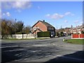

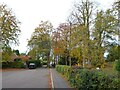
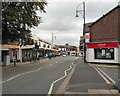
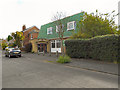
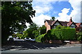
10 photos from this area
Area Information
Key information about the SK7 1EN including its size, population, and administrative classification.
- Area Type
- Postcode
- Area Size
- 1.6 hectares
- Population
- 1498
- Population Density
- 2105 people/km²
House Prices in SK7 1EN
13
Properties
£405,119
Average Sold Price
£243,000
Lowest Price
£588,000
Highest Price
Showing 13 properties
| Address | Type | Beds | Baths | Last Sale Price | Last Sale Date | |
|---|---|---|---|---|---|---|
| 36 Whitehaven Road, Bramhall, Stockport, SK7 1EN | Semi-detached | 4 | 2 | £588,000 | Jan 2025 | |
| 42 Whitehaven Road, Bramhall, Stockport, SK7 1EN | Semi-detached | 3 | 1 | £564,500 | Oct 2023 | |
| 41 Whitehaven Road, Bramhall, Stockport, SK7 1EN | Semi-detached | 4 | 2 | £540,500 | Apr 2020 | |
| 38 Whitehaven Road, Bramhall, Stockport, SK7 1EN | house | - | - | £459,950 | Aug 2017 | |
| 40 Whitehaven Road, Bramhall, Stockport, SK7 1EN | house | - | - | £243,000 | Oct 2009 | |
| 37 Whitehaven Road, Bramhall, Stockport, SK7 1EN | house | - | - | £285,000 | Mar 2007 | |
| 43 Whitehaven Road, Bramhall, Stockport, SK7 1EN | Semi-detached | - | - | £285,000 | Jul 2006 | |
| 32 Whitehaven Road, Bramhall, Stockport, SK7 1EN | Semi-detached | - | - | £275,000 | Aug 2005 | |
| Valley Primary School, Whitehaven Road, Bramhall, Stockport, SK7 1EN | commercial | - | - | - | - | |
| 34 Whitehaven Road, Bramhall, Stockport, SK7 1EN | Semi-detached | - | - | - | - |
Page 1 of 2
Energy Efficiency in SK7 1EN
Amenities
Schools
| Rank | School | Type | Entry gender | Ages |
|---|
Explore more schools in this area
Go to Schools tabDemographics
Household Size
Family (3-5 people)
most common
Accommodation Type
Houses
most common
Tenure
97
majority
Ethnic Group
White
most common
Religion
N/A
most common
Household Composition
N/A
most common
Age
47
median
Adults (30-64 years)
most common
Household Deprivation
N/A
with no deprivation
NS-SEC
54
in Lower managerial occupations
Explore more demographic insights in this area
Go to Demographics tabPlanning
Planning Constraints
- Flood RiskPremium
- Ramsar Wetland SitesPremium
- Area of Outstanding Natural BeautyPremium
- Protected Nature ReservePremium
- Protected WoodlandPremium