Area Overview for SK7 1AF
Photos of SK7 1AF


Area Information
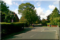
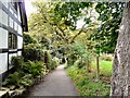
SK7 1AF represents a small, tightly defined residential cluster covering just over 33,800 square metres. With a population of 1,305 residents, this postcode offers a compact living environment where neighbours are likely to know one another. The area is situated in Greater Manchester, within England, and functions as a quiet domestic hub rather than a bustling commercial centre. Daily life here revolves around convenience and stability, with the majority of residents having long-standing ties to the locality. Living in SK7 1AF means enjoying a neighbourhood where houses dominate the streetscape, creating a traditional suburban feel. The high density of people per square kilometre suggests a built-up environment, yet the residential focus keeps noise levels manageable compared to major urban zones. You are looking at a community of 1,305 individuals spread across a small footprint, which often correlates with older estates and established tree-lined roads. This specific cluster is distinct because of its ownership model and demographic profile, differentiating it from the surrounding broader SK7 postcode areas. The area is defined by its practical location rather than grand scenery. It sits close to significant infrastructure, including potential access to Manchester Woodford Airport and various railway stations within a short commute. For those considering homes in SK7 1AF, the primary appeal lies in the turnkey nature of the properties, given the extremely high rate of home ownership. You are entering a settled market where change occurs gradually, providing a predictable setting for raising a family or retiring well.
- Area Type
- Postcode
- Area Size
- 3381 m²
- Population
- 1305
- Population Density
- 3321 people/km²
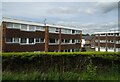
The property market in SK7 1AF is defined by stability and accessibility for current owners. With home ownership reaching 91%, the area is almost entirely occupied by people who live in their own homes. This statistic suggests that the housing stock is established and likely consists of properties owned through inheritance, long-term mortgages, or cash purchases rather than short-term investment portfolios. Accommodation types are exclusively houses, meaning you will not find flats or purpose-built apartments as primary residences in this specific cluster. This homogeneity creates a uniform streetscape and limits the variety of home styles compared to mixed-use developments. For buyers, this means that any properties for sale in SK7 1AF will be standalone houses, likely detached, semi-detached, or terraced depending on the specific street layout. The low percentage of private rentals implies that the local economy supports a workforce that can afford to own property or that intergenerational wealth transfer is common. There is little evidence of a student housing bubble or young professional rental surge typically seen in cities like Manchester or London. Instead, the market functions as a traditional family real estate zone. You should expect competition only when good properties appear, as the supply of housing remains relatively static due to the high concentration of existing owners.
House Prices in SK7 1AF
Showing 6 properties
| Address | Type | Beds | Baths | Last Sale Price | Last Sale Date | |
|---|---|---|---|---|---|---|
| 22A Bramhall Lane South, Bramhall, Stockport, SK7 1AF | Flat | 2 | - | £200,000 | Feb 2005 | |
| 6A Bramhall Lane South, Bramhall, Stockport, SK7 1AF | Retail | - | - | - | - | |
| Flat Above, 8 Bramhall Lane South, Bramhall, Stockport, SK7 1AF | Flat | - | - | - | - | |
| Flat Above, 20 Bramhall Lane South, Bramhall, Stockport, SK7 1AF | Flat | - | - | - | - | |
| Flat Above, 16 Bramhall Lane South, Bramhall, Stockport, SK7 1AF | Flat | - | - | - | - | |
| 20B Bramhall Lane South, Bramhall, Stockport, SK7 1AF | warehouse | - | - | - | - |
Energy Efficiency in SK7 1AF
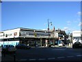
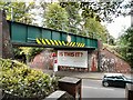
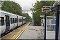
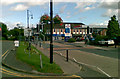
Living in SK7 1AF places you within practical reach of several key retail and transport hubs. The nearest retail options include Sainsburys Bramhall, Tesco Bramhall, and Co-op Dairyground. These three specific supermarkets cover everyday shopping needs from fresh groceries to household essentials. With five retail locations identified, you have convenientoptions without needing to travel far from your home. Transport convenience is underpinned by five accessible railway stations, including Bramhall, Poynton, and Cheadle Hulme. Public transport options allow you to reach Manchester Woodford Airport quickly, as well as major international terminals like Terminal Three and Terminal One. This network supports both business travellers and leisure tourists. Nearby tram stops at Shadowmoss, Peel Hall, and Robinswood Road further integrate the area into the wider Manchester transit system. This blend of retail and rail access defines the lifestyle in SK7 1AF. You can complete your morning shop at a Co-op Dairyground and catch a train to Leeds or London interchangeably. The area supports a car-free or car-light lifestyle for many daily tasks. The presence of these specific named amenities provides a structured routine where essential services are never far away. Residents benefit from a balanced mix of commercial convenience and residential tranquility.
Amenities
Schools
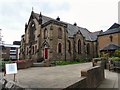
Families living in SK7 1AF have limited formal school data associated directly with their immediate postcode, but the nearest named educational facility is Syddal Park School. This is an independent school, indicating that some residents opt for private education options nearby rather than relying solely on the state sector. The presence of an independent school in the vicinity serves a specific demographic within the community, likely catering to families with the means to afford private tuition or those seeking a particular educational environment outside the state system. While no state schools are listed in the available records for this specific location, the proximity to Syddal Park School confirms access to quality non-state provisions. For homebuyers navigating schools near SK7 1AF, the inclusion of an independent option adds flexibility to the local education landscape. It suggests that the area appeals to families who prefer alternative curricula or smaller class sizes often found in private institutions. However, the reliance on a single named school means that families might also look further afield for state-maintained primary or secondary options depending on their specific needs and catchment boundaries. The existing educational infrastructure supports a diverse approach to schooling within the broader Manchester region.
| Rank | School | Type | Entry gender | Ages |
|---|
Explore more schools in this area
Go to Schools tabDemographics
The community in SK7 1AF is mature and stable. The median age of residents is 47 years, with the 30-64 year age range representing the most common demographic group. This age profile indicates a neighbourhood dominated by families with children and retirees, rather than young professionals or university students. Such a demographic mix often drives specific local business needs, such as family-oriented retail and healthcare services. Home ownership stands at an exceptional 91% within this postcode. This figure places SK7 1AF far above the national average for owner-occupation, firmly establishing it as a settled, long-term residential zone rather than a transient rental market. The overwhelming presence of houses further reinforces the character of the area, distinguishing it from urban concentrations of flats or apartment blocks. Ethnically, the White population group is predominant, aligning with the broader demographic patterns of many established English suburbs. While the data highlights a specific dominant group, the sheer stability of the ownership rate suggests a community built on generational ties. There are no significant signs of recent rapid migration or population fluctuation in this specific dataset. The high percentage of owner-occupied dwellings correlates with a desire for permanence and a lower likelihood of short-term tenancy turnovers.
Household Size
Accommodation Type
Tenure
Ethnic Group
Religion
Household Composition
Age
Household Deprivation
NS-SEC
Explore more demographic insights in this area
Go to Demographics tabPlanning
Planning Constraints
- Flood RiskPremium
- Ramsar Wetland SitesPremium
- Area of Outstanding Natural BeautyPremium
- Protected Nature ReservePremium
- Protected WoodlandPremium