Area Overview for SK6 7QY
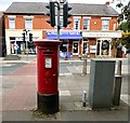
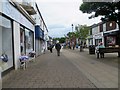
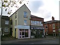
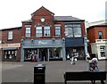
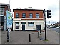
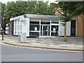
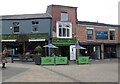
Photos of SK6 7QY

Area Information
SK6 7QY is a specific postcode covering a small residential cluster on the Cheshire border, characterised by its concentrated housing stock. The area encompasses a total land mass of 5992 square metres, supporting a population of 1749 people. This density creates a tightly knit environment where neighbours are often close by, typical of a residential site in such a restricted footprint. The population density figure reaches a remarkably high 291868 people per square kilometre when calculated for this specific cluster, indicating that homes are situated very near one another. Residents here experience a quiet, domestic existence focused on the immediate street network rather than sprawling suburbs. Living in SK6 7QY means having a defined sense of place without the vast distances found in larger districts. You will find a community where the streets are defined by proximity rather than long commutes within the estate itself. The area operates as a self-contained residential zone, where daily life revolves around the immediate surroundings and access to nearby towns. This compact nature distinguishes it from wider postal districts that cover larger geographic territories.
- Area Type
- Postcode
- Area Size
- 5992 m²
- Population
- 1749
- Population Density
- 1936 people/km²
Homes in SK6 7QY are predominantly owner-occupied, with 63 per cent of residents holding title to their property. This statistic defines the market character as a stable, owner-led environment rather than a hub of short-term tenants or investors. The accommodation type data confirms that the physical stock consists of houses, filtering out high-rise flats or terraced blocks that might dominate elsewhere. You are looking at a market where buyers typically intend to stay for the long term. The 63 per cent ownership rate implies that sales activity is driven by life-cycle changes rather than speculative flipping. This area offers homes for those seeking a traditional housing environment where the majority have purchased their dwellings. The nature of the property mix suggests that new builds or modern conversions are not the primary driver, as the existing stock of houses supports the current demographic. Buying in SK6 7QY involves entering a market where the incumbent residents have a strong financial stake in the neighbourhood. This stability often translates to lower turnover and a more consistent property value trajectory compared to volatile rental-heavy areas.
House Prices in SK6 7QY
No properties found in this postcode.
Energy Efficiency in SK6 7QY
Daily life in SK6 7QY benefits from strong local retail and transport links. Asda Marple, Co-op Marple, and Iceland Marple offer essential shopping needs within easy reach. This selection of supermarkets and drugstores allows you to handle most household procurement without travelling far. Rail transport is highly accessible, with Rose Hill Marple Railway Station, Marple Railway Station, and Romiley Railway Station listed as nearby options. Five railway stations in the vicinity provide excellent flexibility for commuters travelling into Manchester or beyond. Manchester Woodford Airport is also located nearby, offering air travel possibilities for residents requiring flights. This concentration of amenities means that your daily necessities are all within practical reach. You do not need to venture deep into the city centre for groceries, general shopping, or catching a train. The area is defined by this convenient access to established brands and transport hubs. Living here offers the convenience of urban amenities combined with the quieter setting of a residential cluster.
Amenities
Schools
Families living in or near SK6 7QY have access to a range of educational institutions. Peacefield Primary School serves as a local primary option for younger children. Marple Ridge High School is also located nearby, providing secondary education services to the community. For older students, The Ridge College operates as a sixth-form institution, offering further education opportunities close to home. This cluster of schools ensures that residents can find education from early years through to A-levels without lengthy travel. The presence of these specific schools means you do not need to look beyond the local vicinity for primary or secondary education. You will find that the choice of schools is limited to these specific named institutions, which shape the local family ecosystem. Schools near SK6 7QY are readily accessible by foot or short drive, integrating education into the daily rhythm of the postcode. This educational infrastructure supports the demographic profile of adults aged 30 to 64 who are likely navigating their children through the system. The availability of a sixth-form college nearby is a practical benefit for teenagers finishing their academic journey.
| Rank | School | Type | Entry gender | Ages |
|---|
Explore more schools in this area
Go to Schools tabDemographics
The community in SK6 7QY reflects a mature demographic, with a median age of 47 years. The most common age range is adults between 30 and 64 years, suggesting a population settled in their careers and families. Home ownership stands at 63 per cent, indicating that many residents have secured their property rather than renting. This majority of owner-occupiers contributes to a stable community atmosphere. Accommodation types in the area consist primarily of houses, aligning with the preference for detached or semi-detached family living found in this postcode. The predominant ethnic group is White, which forms the majority of the local population composition. You will find a neighbourhood where long-term residents likely hold significant sway over local decisions. The high proportion of home ownership suggests a preference for stability over the mobility often seen in rental markets. This demographic profile points towards families leaving school and adults establishing careers, creating a settled environment. Living here offers a so-called "British suburban" feel with a clear majority of mortgage holders in the streets you might walk down.
Household Size
Accommodation Type
Tenure
Ethnic Group
Religion
Household Composition
Age
Household Deprivation
NS-SEC
Explore more demographic insights in this area
Go to Demographics tabPlanning
Planning Constraints
- Flood RiskPremium
- Ramsar Wetland SitesPremium
- Area of Outstanding Natural BeautyPremium
- Protected Nature ReservePremium
- Protected WoodlandPremium