Area Overview for SK6 7GD
Photos of SK6 7GD


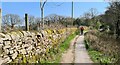
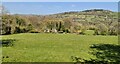

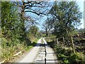
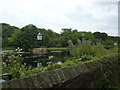
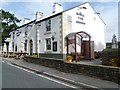
34 photos from this area
Area Information
Key information about the SK6 7GD including its size, population, and administrative classification.
- Area Type
- Postcode
- Area Size
- 5.5 hectares
- Population
- 1495
- Population Density
- 432 people/km²
House Prices in SK6 7GD
17
Properties
£193,702
Average Sold Price
£58,473
Lowest Price
£387,000
Highest Price
Showing 17 properties
| Address | Type | Beds | Baths | Last Sale Price | Last Sale Date | |
|---|---|---|---|---|---|---|
| 147 Strines Road, Strines, Stockport, SK6 7GD | Semi-detached | 3 | 1 | £387,000 | Oct 2024 | |
| 155 Strines Road, Strines, Stockport, SK6 7GD | house | - | - | £257,000 | Jul 2021 | |
| 163 Strines Road, Strines, Stockport, SK6 7GD | house | - | - | £261,300 | Jan 2021 | |
| 159 Strines Road, Strines, Stockport, SK6 7GD | Semi-detached | 4 | 1 | £260,000 | Dec 2019 | |
| 161 Strines Road, Strines, Stockport, SK6 7GD | Semi-detached | 3 | - | £146,000 | Dec 2016 | |
| 145 Strines Road, Strines, Stockport, SK6 7GD | Semi-detached | 3 | - | £200,000 | Dec 2014 | |
| 141 Strines Road, Strines, Stockport, SK6 7GD | house | - | - | £165,000 | Jan 2014 | |
| 135 Strines Road, Strines, Stockport, SK6 7GD | house | - | - | £58,473 | Apr 2011 | |
| 157 Strines Road, Strines, Stockport, SK6 7GD | Terraced | - | - | £146,000 | Nov 2010 | |
| 149 Strines Road, Strines, Stockport, SK6 7GD | Semi-detached | - | - | £165,000 | May 2006 |
Page 1 of 2
Energy Efficiency in SK6 7GD
Amenities
Schools
| Rank | School | Type | Entry gender | Ages |
|---|
Explore more schools in this area
Go to Schools tabDemographics
Household Size
Two person
most common
Accommodation Type
Houses
most common
Tenure
88
majority
Ethnic Group
White
most common
Religion
N/A
most common
Household Composition
N/A
most common
Age
47
median
Adults (30-64 years)
most common
Household Deprivation
N/A
with no deprivation
NS-SEC
43
in Lower managerial occupations
Explore more demographic insights in this area
Go to Demographics tabPlanning
Planning Constraints
- Flood RiskPremium
- Ramsar Wetland SitesPremium
- Area of Outstanding Natural BeautyPremium
- Protected Nature ReservePremium
- Protected WoodlandPremium