Area Overview for SK6 6HG
Photos of SK6 6HG
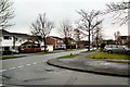
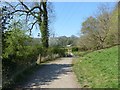
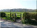
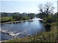
35 photos from this area
Area Information
Key information about the SK6 6HG including its size, population, and administrative classification.
- Area Type
- Postcode
- Area Size
- 1.3 hectares
- Population
- 1435
- Population Density
- 1365 people/km²
House Prices in SK6 6HG
27
Properties
£267,113
Average Sold Price
£55,000
Lowest Price
£505,000
Highest Price
Showing 27 properties
| Address | Type | Beds | Baths | Last Sale Price | Last Sale Date | |
|---|---|---|---|---|---|---|
| 47 The Turnpike, Marple, Stockport, SK6 6HG | house | 3 | - | £345,000 | Aug 2024 | |
| 33 The Turnpike, Marple, Stockport, SK6 6HG | Semi-detached | 3 | 2 | £370,000 | Jul 2024 | |
| 40 The Turnpike, Marple, Stockport, SK6 6HG | Semi-detached | 4 | 2 | £505,000 | Sep 2023 | |
| 49 The Turnpike, Marple, Stockport, SK6 6HG | house | - | - | £365,000 | Mar 2021 | |
| 68 The Turnpike, Marple, Stockport, SK6 6HG | house | - | - | £482,500 | Jan 2021 | |
| 58 The Turnpike, Marple, Stockport, SK6 6HG | Semi-detached | 3 | 1 | £305,000 | Apr 2020 | |
| 54 The Turnpike, Marple, Stockport, SK6 6HG | Bungalow | - | - | £349,950 | Sep 2019 | |
| 35 The Turnpike, Marple, Stockport, SK6 6HG | Semi-detached | 3 | 1 | £275,000 | May 2019 | |
| 45 The Turnpike, Marple, Stockport, SK6 6HG | Detached | 3 | - | £250,000 | Jul 2015 | |
| 42 The Turnpike, Marple, Stockport, SK6 6HG | house | 3 | - | £207,000 | Jul 2015 |
Page 1 of 3
Energy Efficiency in SK6 6HG
Amenities
Schools
| Rank | School | Type | Entry gender | Ages |
|---|
Explore more schools in this area
Go to Schools tabDemographics
Household Size
Two person
most common
Accommodation Type
Houses
most common
Tenure
95
majority
Ethnic Group
White
most common
Religion
N/A
most common
Household Composition
N/A
most common
Age
47
median
Adults (30-64 years)
most common
Household Deprivation
N/A
with no deprivation
NS-SEC
50
in Lower managerial occupations
Explore more demographic insights in this area
Go to Demographics tabPlanning
Planning Constraints
- Flood RiskPremium
- Ramsar Wetland SitesPremium
- Area of Outstanding Natural BeautyPremium
- Protected Nature ReservePremium
- Protected WoodlandPremium