Area Overview for SK6 6DH
Photos of SK6 6DH

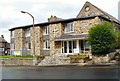
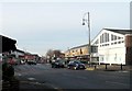
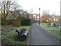
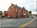


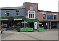
73 photos from this area
Area Information
Key information about the SK6 6DH including its size, population, and administrative classification.
- Area Type
- Postcode
- Area Size
- 1366 m²
- Population
- 1318
- Population Density
- 6027 people/km²
House Prices in SK6 6DH
12
Properties
£90,967
Average Sold Price
£62,800
Lowest Price
£109,000
Highest Price
Showing 12 properties
| Address | Type | Beds | Baths | Last Sale Price | Last Sale Date | |
|---|---|---|---|---|---|---|
| 8, Norbury Mews, 159 Stockport Road, Marple, Stockport, SK6 6DH | Flat | - | - | £91,500 | Mar 2024 | |
| 5, Norbury Mews, 159 Stockport Road, Marple, Stockport, SK6 6DH | Flat | - | - | £101,500 | Sep 2022 | |
| 4, Norbury Mews, 159 Stockport Road, Marple, Stockport, SK6 6DH | Flat | - | - | £97,000 | Sep 2021 | |
| 12, Norbury Mews, 159 Stockport Road, Marple, Stockport, SK6 6DH | Flat | - | - | £104,000 | Jun 2021 | |
| 9, Norbury Mews, 159 Stockport Road, Marple, Stockport, SK6 6DH | Flat | - | - | £108,870 | Nov 2020 | |
| 11, Norbury Mews, 159 Stockport Road, Marple, Stockport, SK6 6DH | Flat | - | - | £109,000 | Aug 2020 | |
| 7, Norbury Mews, 159 Stockport Road, Marple, Stockport, SK6 6DH | Flat | - | - | £75,000 | May 2014 | |
| 3, Norbury Mews, 159 Stockport Road, Marple, Stockport, SK6 6DH | Flat | - | - | £62,800 | Jul 2009 | |
| 2, Norbury Mews, 159 Stockport Road, Marple, Stockport, SK6 6DH | Flat | 1 | 1 | £67,000 | Dec 2008 | |
| 6, Norbury Mews, 159 Stockport Road, Marple, Stockport, SK6 6DH | Flat | 1 | 1 | £93,000 | Mar 2006 |
Page 1 of 2
Energy Efficiency in SK6 6DH
Amenities
Schools
| Rank | School | Type | Entry gender | Ages |
|---|
Explore more schools in this area
Go to Schools tabDemographics
Household Size
Two person
most common
Accommodation Type
Houses
most common
Tenure
72
majority
Ethnic Group
White
most common
Religion
N/A
most common
Household Composition
N/A
most common
Age
47
median
Adults (30-64 years)
most common
Household Deprivation
N/A
with no deprivation
NS-SEC
39
in Lower managerial occupations
Explore more demographic insights in this area
Go to Demographics tabPlanning
Planning Constraints
- Flood RiskPremium
- Ramsar Wetland SitesPremium
- Area of Outstanding Natural BeautyPremium
- Protected Nature ReservePremium
- Protected WoodlandPremium