Area Overview for SK6 5JE
Photos of SK6 5JE


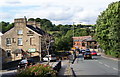
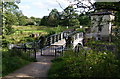
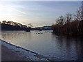
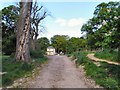
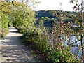
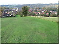
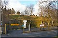

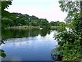
100 photos from this area
Area Information
Key information about the SK6 5JE including its size, population, and administrative classification.
- Area Type
- Postcode
- Area Size
- 8100 m²
- Population
- 1708
- Population Density
- 385 people/km²
House Prices in SK6 5JE
38
Properties
£206,403
Average Sold Price
£135,000
Lowest Price
£347,250
Highest Price
Showing 38 properties
| Address | Type | Beds | Baths | Last Sale Price | Last Sale Date | |
|---|---|---|---|---|---|---|
| 138 Montagu Street, Compstall, Stockport, SK6 5JE | Cottage | 2 | 1 | £305,000 | Sep 2025 | |
| 135 Montagu Street, Compstall, Stockport, SK6 5JE | house | - | - | £282,000 | Mar 2025 | |
| 141 Montagu Street, Compstall, Stockport, SK6 5JE | house | - | - | £200,000 | Nov 2024 | |
| 152 Montagu Street, Compstall, Stockport, SK6 5JE | Cottage | 3 | 1 | £204,000 | Oct 2023 | |
| 137 Montagu Street, Compstall, Stockport, SK6 5JE | house | - | - | £305,000 | Apr 2023 | |
| 127 Montagu Street, Compstall, Stockport, SK6 5JE | Terraced | 2 | 1 | £223,000 | Mar 2023 | |
| 150 Montagu Street, Compstall, Stockport, SK6 5JE | house | - | - | £168,000 | Sep 2020 | |
| Warren Lodge, Montagu Street, Compstall, Stockport, SK6 5JE | Bungalow | 3 | 1 | £347,250 | Nov 2018 | |
| 160 Montagu Street, Compstall, Stockport, SK6 5JE | Cottage | 2 | - | £185,000 | Nov 2018 | |
| 158 Montagu Street, Compstall, Stockport, SK6 5JE | Terraced | 2 | - | £180,000 | Sep 2018 |
Page 1 of 4
Energy Efficiency in SK6 5JE
Amenities
Schools
| Rank | School | Type | Entry gender | Ages |
|---|
Explore more schools in this area
Go to Schools tabDemographics
Household Size
Family (3-5 people)
most common
Accommodation Type
Houses
most common
Tenure
77
majority
Ethnic Group
White
most common
Religion
N/A
most common
Household Composition
N/A
most common
Age
47
median
Adults (30-64 years)
most common
Household Deprivation
N/A
with no deprivation
NS-SEC
37
in Lower managerial occupations
Explore more demographic insights in this area
Go to Demographics tabPlanning
Planning Constraints
- Flood RiskPremium
- Ramsar Wetland SitesPremium
- Area of Outstanding Natural BeautyPremium
- Protected Nature ReservePremium
- Protected WoodlandPremium