Area Overview for SK6 4PZ
Photos of SK6 4PZ
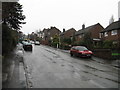
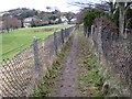
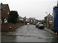
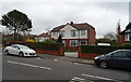
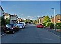
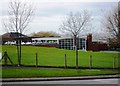
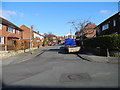
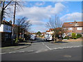
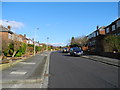
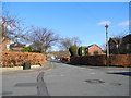
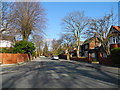
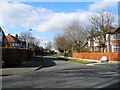
37 photos from this area
Area Information
Key information about the SK6 4PZ including its size, population, and administrative classification.
- Area Type
- Postcode
- Area Size
- 1.0 hectares
- Population
- 1457
- Population Density
- 1241 people/km²
House Prices in SK6 4PZ
19
Properties
£222,275
Average Sold Price
£80,000
Lowest Price
£425,000
Highest Price
Showing 19 properties
| Address | Type | Beds | Baths | Last Sale Price | Last Sale Date | |
|---|---|---|---|---|---|---|
| 24 Greave Fold, Romiley, Stockport, SK6 4PZ | Cottage | 2 | 1 | £185,000 | Dec 2023 | |
| 30 Greave Fold, Romiley, Stockport, SK6 4PZ | house | 2 | 1 | £335,500 | Jul 2023 | |
| 8 Greave Fold, Romiley, Stockport, SK6 4PZ | Retail | 2 | 1 | £260,000 | Jul 2023 | |
| 20 Greave Fold, Romiley, Stockport, SK6 4PZ | Cottage | 2 | 1 | £203,750 | Dec 2021 | |
| 10 Greave Fold, Romiley, Stockport, SK6 4PZ | house | - | - | £175,000 | Jun 2021 | |
| 12 Greave Fold, Romiley, Stockport, SK6 4PZ | Terraced | 2 | 1 | £145,000 | Feb 2018 | |
| 32 Greave Fold, Romiley, Stockport, SK6 4PZ | Terraced | - | - | £425,000 | Sep 2003 | |
| 22 Greave Fold, Romiley, Stockport, SK6 4PZ | Terraced | - | - | £80,000 | Dec 2002 | |
| Upcroft, Greave Fold, Romiley, Stockport, SK6 4PZ | Detached | - | - | £164,000 | Sep 2001 | |
| Church House, Greave Fold, Romiley, Stockport, SK6 4PZ | Detached | 5 | 4 | £249,500 | Jan 2001 |
Page 1 of 2
Energy Efficiency in SK6 4PZ
Amenities
Schools
| Rank | School | Type | Entry gender | Ages |
|---|
Explore more schools in this area
Go to Schools tabDemographics
Household Size
Two person
most common
Accommodation Type
Houses
most common
Tenure
94
majority
Ethnic Group
White
most common
Religion
N/A
most common
Household Composition
N/A
most common
Age
47
median
Adults (30-64 years)
most common
Household Deprivation
N/A
with no deprivation
NS-SEC
50
in Lower managerial occupations
Explore more demographic insights in this area
Go to Demographics tabPlanning
Planning Constraints
- Flood RiskPremium
- Ramsar Wetland SitesPremium
- Area of Outstanding Natural BeautyPremium
- Protected Nature ReservePremium
- Protected WoodlandPremium