Area Overview for SK6 2QA
Photos of SK6 2QA
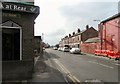
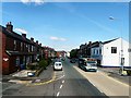
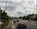
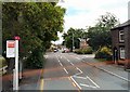
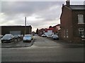
100 photos from this area
Area Information
Key information about the SK6 2QA including its size, population, and administrative classification.
- Area Type
- Postcode
- Area Size
- 8709 m²
- Population
- 1656
- Population Density
- 5237 people/km²
House Prices in SK6 2QA
23
Properties
£202,568
Average Sold Price
£51,000
Lowest Price
£370,000
Highest Price
Showing 23 properties
| Address | Type | Beds | Baths | Last Sale Price | Last Sale Date | |
|---|---|---|---|---|---|---|
| 15 Elderfield Drive, Bredbury, Stockport, SK6 2QA | Bungalow | 2 | 1 | £295,000 | Jan 2025 | |
| 6 Elderfield Drive, Bredbury, Stockport, SK6 2QA | Bungalow | 3 | 1 | £370,000 | Dec 2023 | |
| 4 Elderfield Drive, Bredbury, Stockport, SK6 2QA | Semi-detached | 3 | 1 | £274,000 | Mar 2023 | |
| 5 Elderfield Drive, Bredbury, Stockport, SK6 2QA | Bungalow | - | - | £248,000 | Mar 2022 | |
| 14 Elderfield Drive, Bredbury, Stockport, SK6 2QA | house | 4 | - | £346,000 | Apr 2021 | |
| 28 Elderfield Drive, Bredbury, Stockport, SK6 2QA | Bungalow | 3 | 1 | £225,000 | Aug 2019 | |
| 26 Elderfield Drive, Bredbury, Stockport, SK6 2QA | Semi-detached | 3 | 1 | £164,000 | Dec 2014 | |
| 10 Elderfield Drive, Bredbury, Stockport, SK6 2QA | Semi-detached | 2 | 1 | £152,000 | Nov 2014 | |
| 3 Elderfield Drive, Bredbury, Stockport, SK6 2QA | Semi-detached | 2 | 1 | £125,000 | Feb 2013 | |
| 7 Elderfield Drive, Bredbury, Stockport, SK6 2QA | Semi-detached | - | - | £158,000 | Nov 2007 |
Page 1 of 3
Energy Efficiency in SK6 2QA
Amenities
Schools
| Rank | School | Type | Entry gender | Ages |
|---|
Explore more schools in this area
Go to Schools tabDemographics
Household Size
Two person
most common
Accommodation Type
Houses
most common
Tenure
83
majority
Ethnic Group
White
most common
Religion
N/A
most common
Household Composition
N/A
most common
Age
47
median
Adults (30-64 years)
most common
Household Deprivation
N/A
with no deprivation
NS-SEC
36
in Lower managerial occupations
Explore more demographic insights in this area
Go to Demographics tabPlanning
Planning Constraints
- Flood RiskPremium
- Ramsar Wetland SitesPremium
- Area of Outstanding Natural BeautyPremium
- Protected Nature ReservePremium
- Protected WoodlandPremium