Area Overview for SK6 2NN
Photos of SK6 2NN
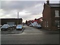
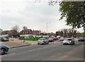
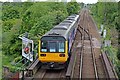
100 photos from this area
Area Information
Key information about the SK6 2NN including its size, population, and administrative classification.
- Area Type
- Postcode
- Area Size
- 3537 m²
- Population
- 1400
- Population Density
- 6037 people/km²
House Prices in SK6 2NN
22
Properties
£101,343
Average Sold Price
£19,250
Lowest Price
£185,000
Highest Price
Showing 22 properties
| Address | Type | Beds | Baths | Last Sale Price | Last Sale Date | |
|---|---|---|---|---|---|---|
| 68 Lower Bents Lane, Bredbury, Stockport, SK6 2NN | Terraced | 2 | 1 | £185,000 | Mar 2024 | |
| 84 Lower Bents Lane, Bredbury, Stockport, SK6 2NN | house | - | - | £111,500 | Jul 2020 | |
| 82 Lower Bents Lane, Bredbury, Stockport, SK6 2NN | Terraced | 2 | 1 | £139,950 | Mar 2018 | |
| 96 Lower Bents Lane, Bredbury, Stockport, SK6 2NN | Terraced | 3 | 1 | £123,000 | Mar 2016 | |
| 70 Lower Bents Lane, Bredbury, Stockport, SK6 2NN | Terraced | 2 | 1 | £110,500 | Mar 2016 | |
| 78 Lower Bents Lane, Bredbury, Stockport, SK6 2NN | Terraced | 2 | 1 | £113,000 | Dec 2015 | |
| 60 Lower Bents Lane, Bredbury, Stockport, SK6 2NN | house | 3 | 1 | £118,500 | Mar 2015 | |
| 80 Lower Bents Lane, Bredbury, Stockport, SK6 2NN | Terraced | 2 | 1 | £87,675 | Nov 2013 | |
| 66 Lower Bents Lane, Bredbury, Stockport, SK6 2NN | Terraced | 2 | 1 | £106,000 | Apr 2009 | |
| 72 Lower Bents Lane, Bredbury, Stockport, SK6 2NN | Terraced | - | - | £117,000 | Aug 2007 |
Page 1 of 3
Energy Efficiency in SK6 2NN
Amenities
Schools
| Rank | School | Type | Entry gender | Ages |
|---|
Explore more schools in this area
Go to Schools tabDemographics
Household Size
Family (3-5 people)
most common
Accommodation Type
Houses
most common
Tenure
77
majority
Ethnic Group
White
most common
Religion
N/A
most common
Household Composition
N/A
most common
Age
47
median
Adults (30-64 years)
most common
Household Deprivation
N/A
with no deprivation
NS-SEC
28
in Lower managerial occupations
Explore more demographic insights in this area
Go to Demographics tabPlanning
Planning Constraints
- Flood RiskPremium
- Ramsar Wetland SitesPremium
- Area of Outstanding Natural BeautyPremium
- Protected Nature ReservePremium
- Protected WoodlandPremium