Area Overview for SK6 2HF
Photos of SK6 2HF
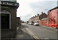
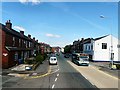
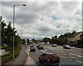
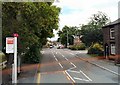
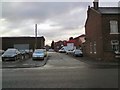
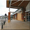
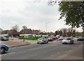

100 photos from this area
Area Information
Key information about the SK6 2HF including its size, population, and administrative classification.
- Area Type
- Postcode
- Area Size
- 1.3 hectares
- Population
- 1274
- Population Density
- 2959 people/km²
House Prices in SK6 2HF
35
Properties
£186,628
Average Sold Price
£53,000
Lowest Price
£330,000
Highest Price
Showing 35 properties
| Address | Type | Beds | Baths | Last Sale Price | Last Sale Date | |
|---|---|---|---|---|---|---|
| 10 Redhill Drive, Bredbury, Stockport, SK6 2HF | house | - | - | £275,000 | Feb 2024 | |
| 7 Redhill Drive, Bredbury, Stockport, SK6 2HF | Semi-detached | 4 | 2 | £305,000 | Sep 2023 | |
| 26 Redhill Drive, Bredbury, Stockport, SK6 2HF | Retail | 3 | 1 | £300,000 | Nov 2022 | |
| 21 Redhill Drive, Bredbury, Stockport, SK6 2HF | house | - | - | £282,750 | Oct 2022 | |
| 18 Redhill Drive, Bredbury, Stockport, SK6 2HF | Semi-detached | 3 | 1 | £240,000 | Jan 2022 | |
| 28 Redhill Drive, Bredbury, Stockport, SK6 2HF | house | - | - | £330,000 | Jun 2021 | |
| 15 Redhill Drive, Bredbury, Stockport, SK6 2HF | house | - | - | £295,000 | Jun 2021 | |
| 5 Redhill Drive, Bredbury, Stockport, SK6 2HF | Semi-detached | 3 | 1 | £200,000 | Apr 2020 | |
| 23 Redhill Drive, Bredbury, Stockport, SK6 2HF | Semi-detached | 3 | 1 | £194,950 | Jun 2016 | |
| 27 Redhill Drive, Bredbury, Stockport, SK6 2HF | Semi-detached | 3 | 1 | £165,000 | Mar 2016 |
Page 1 of 4
Energy Efficiency in SK6 2HF
Amenities
Schools
| Rank | School | Type | Entry gender | Ages |
|---|
Explore more schools in this area
Go to Schools tabDemographics
Household Size
Two person
most common
Accommodation Type
Houses
most common
Tenure
89
majority
Ethnic Group
White
most common
Religion
N/A
most common
Household Composition
N/A
most common
Age
47
median
Adults (30-64 years)
most common
Household Deprivation
N/A
with no deprivation
NS-SEC
32
in Lower managerial occupations
Explore more demographic insights in this area
Go to Demographics tabPlanning
Planning Constraints
- Flood RiskPremium
- Ramsar Wetland SitesPremium
- Area of Outstanding Natural BeautyPremium
- Protected Nature ReservePremium
- Protected WoodlandPremium