Area Overview for SK6 2EA
Photos of SK6 2EA
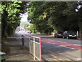
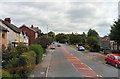
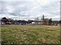
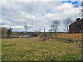
41 photos from this area
Area Information
Key information about the SK6 2EA including its size, population, and administrative classification.
- Area Type
- Postcode
- Area Size
- 8215 m²
- Population
- 1274
- Population Density
- 2959 people/km²
House Prices in SK6 2EA
19
Properties
£155,680
Average Sold Price
£49,000
Lowest Price
£330,000
Highest Price
Showing 19 properties
| Address | Type | Beds | Baths | Last Sale Price | Last Sale Date | |
|---|---|---|---|---|---|---|
| 39 Valley Road, Bredbury, Stockport, SK6 2EA | Semi-detached | 5 | 2 | £330,000 | Jan 2024 | |
| 17 Valley Road, Bredbury, Stockport, SK6 2EA | Semi-detached | 3 | 1 | £165,000 | Aug 2023 | |
| 19 Valley Road, Bredbury, Stockport, SK6 2EA | house | - | - | £225,000 | Mar 2022 | |
| 25 Valley Road, Bredbury, Stockport, SK6 2EA | Semi-detached | 3 | 1 | £167,000 | Oct 2016 | |
| 35 Valley Road, Bredbury, Stockport, SK6 2EA | Semi-detached | - | - | £180,500 | May 2008 | |
| 33 Valley Road, Bredbury, Stockport, SK6 2EA | Semi-detached | 3 | - | £172,000 | Dec 2006 | |
| 29 Valley Road, Bredbury, Stockport, SK6 2EA | Semi-detached | - | - | £121,000 | Mar 2003 | |
| 9 Valley Road, Bredbury, Stockport, SK6 2EA | Semi-detached | - | - | £94,950 | Sep 2002 | |
| 3 Valley Road, Bredbury, Stockport, SK6 2EA | house | 3 | - | £49,000 | Feb 1997 | |
| 7 Valley Road, Bredbury, Stockport, SK6 2EA | Semi-detached | - | - | £52,350 | Jan 1997 |
Page 1 of 2
Energy Efficiency in SK6 2EA
Amenities
Schools
| Rank | School | Type | Entry gender | Ages |
|---|
Explore more schools in this area
Go to Schools tabDemographics
Household Size
Two person
most common
Accommodation Type
Houses
most common
Tenure
89
majority
Ethnic Group
White
most common
Religion
N/A
most common
Household Composition
N/A
most common
Age
47
median
Adults (30-64 years)
most common
Household Deprivation
N/A
with no deprivation
NS-SEC
32
in Lower managerial occupations
Explore more demographic insights in this area
Go to Demographics tabPlanning
Planning Constraints
- Flood RiskPremium
- Ramsar Wetland SitesPremium
- Area of Outstanding Natural BeautyPremium
- Protected Nature ReservePremium
- Protected WoodlandPremium