Area Overview for SK6 2BX
Photos of SK6 2BX

Area Information
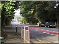
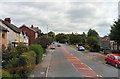
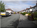
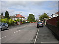
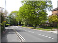
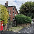
SK6 2BX represents a specific residential cluster in Greater Manchester, serving a population of 1,669 households. This postcode area functions as a contained living environment where residents rely on nearby hubs for wider services. The location sits near key transport arteries and commercial centres, balancing suburban living with reasonable access to employment and shopping. You are looking at a community defined by its proximity to Bredbury, Ashton, and Didsbury rather than extensive internal amenities. Daily life here revolves around short commutes to railway stations like Bredbury Railway Station and Brinnington Railway Station. These stations feed into the local rail network, connecting you to Manchester and beyond. The area benefits from a strong mix of supermarkets within a practical driving distance, including Morrisons Lower and Asda Bredbury. You will not find extensive parks or large leisure complexes directly within the immediate SK6 2BX boundaries, so your routine will involve travelling to Ashton or Chorlton Street Coach Station for broader activities. The neighbourhood caters primarily to those who have established homes in the area, reflecting high rates of homeownership. You are entering an environment where the existing housing stock dominates new developments. The small population size creates a quiet atmosphere compared to larger urban districts, but it means you must travel slightly further for specialized schooling or major retail outlets. Living in SK6 2BX means prioritising established character over the convenience of having every service on your doorstep.
- Area Type
- Postcode
- Area Size
- Not available
- Population
- 1669
- Population Density
- 2292 people/km²
The housing market in SK6 2BX is defined by a single accommodation type: houses. The absence of flats or apartments means buyers here are exclusively looking for detached, semi-detached, or terraced housing options. This uniformity offers clarity for buyers who know they want a traditional property with a garden, but it limits options for those seeking smaller, urban-style homes. With an 84% homeownership rate, the area is overwhelmingly owned-occupied rather than privately rented. This statistic indicates that people have chosen to buy into SK6 2BX permanently, rather than renting for a few years. You will find fewer landlord-owned properties on the market compared to cities like Manchester or Sheffield. This stability often makes the area attractive to investors looking for long-term performance rather than short-term rental yields. Living in this postcode means accepting that the local property stock is mature. New builds are rare within the immediate boundaries, so the available homes reflect decades of development history. Prices reflect this stability and the high demand from local buyers who value the house-centric lifestyle. If you are a first-time buyer requiring a leasehold apartment, SK6 2BX will not meet your needs. However, if you seek a standalone house in a settled community, the market is supportive and predictable.
House Prices in SK6 2BX
No properties found in this postcode.
Energy Efficiency in SK6 2BX
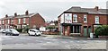
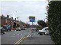
Residents of SK6 2BX enjoy excellent access to retail and dining, concentrated in nearby towns rather than within the immediate postcode. Five major retail locations surround the area, including Morrisons Lower, Asda Bredbury, and Spar Ashton. You will have your weekly groceries and daily necessities within a short drive, removing the need to travel far into Manchester city centre. These supermarkets are well-proportioned for family shopping and offer full ranges of products. For leisure and evening activities, you will head towards the East Didsbury and Didsbury Village hub. These areas host numerous bars, restaurants, and shops, providing a more vibrant nightlife than the quiet residential cluster of SK6 2BX itself. You can easily spend a weekend exploring Audenshaw or Bredbury for cinema, parks, and broader entertainment options. This decentralised lifestyle requires a car for occasional outings, but daily errands remain manageable. Local transport nodes include three railway stations: Bredbury, Brinnington, and Romiley. These stations act as gateways to larger cultural centres. For coach travel, the nearby Chorlton Street Coach Station offers regional connections. Manchester Woodford Airport is also within reach, providing access to flights for those needing air travel. Living in SK6 2BX means enjoying a calm start to your day and heading out for amenities when needed. The area prioritises convenience and accessibility without the crowding of dense urban centres.
Amenities
Schools
| Rank | School | Type | Entry gender | Ages |
|---|
Explore more schools in this area
Go to Schools tabDemographics
The community within SK6 2BX skews significantly towards the middle and later years of life. The median age for residents is 47, and the most common age range is adults between 30 and 64 years. This profile suggests the area is favoured by families and professionals seeking stability rather than young people entering the market or retirees needing care-focused services. You are joining a demographic that has likely built significant local roots, as indicated by property tenure data. Homeownership stands at 84%, making this one of the most secure property markets in the region. Almost all accommodation consists of houses, confirming that flats or apartments are virtually absent from this specific postcode. You are not buying into a transient rental scheme but joining a settled population of long-term residents. This high ownership rate often correlates with quieter streets and owners who maintain their properties well. Ethnically, the area is predominantly White, mirroring the broader settlement patterns of many inner-rural Manchester postcodes. The demographic is relatively homogenous, lacking the high diversity found in city centres. This consistency often appeals to buyers preferring a predictable community environment. The concentration of older adults and established families creates a neighbourhood where children play outside and local businesses serve familiar customers daily.
Household Size
Accommodation Type
Tenure
Ethnic Group
Religion
Household Composition
Age
Household Deprivation
NS-SEC
Explore more demographic insights in this area
Go to Demographics tabPlanning
Planning Constraints
- Flood RiskPremium
- Ramsar Wetland SitesPremium
- Area of Outstanding Natural BeautyPremium
- Protected Nature ReservePremium
- Protected WoodlandPremium