Area Overview for SK6 2BQ
Photos of SK6 2BQ
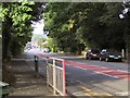
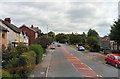
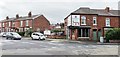
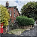
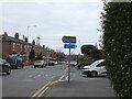
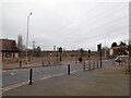
41 photos from this area
Area Information
Key information about the SK6 2BQ including its size, population, and administrative classification.
- Area Type
- Postcode
- Area Size
- 2.6 hectares
- Population
- 1669
- Population Density
- 2292 people/km²
House Prices in SK6 2BQ
29
Properties
£160,879
Average Sold Price
£26,500
Lowest Price
£305,000
Highest Price
Showing 29 properties
| Address | Type | Beds | Baths | Last Sale Price | Last Sale Date | |
|---|---|---|---|---|---|---|
| 794 Stockport Road West, Bredbury, Stockport, SK6 2BQ | Terraced | 3 | 1 | £290,000 | Nov 2024 | |
| 770 Stockport Road West, Bredbury, Stockport, SK6 2BQ | Semi-detached | 3 | 1 | £257,500 | May 2021 | |
| 804 Stockport Road West, Bredbury, Stockport, SK6 2BQ | Semi-detached | 4 | 2 | £305,000 | Mar 2021 | |
| 762 Stockport Road West, Bredbury, Stockport, SK6 2BQ | Semi-detached | 3 | 1 | £185,000 | Mar 2016 | |
| 806 Stockport Road West, Bredbury, Stockport, SK6 2BQ | Semi-detached | 3 | 1 | £193,000 | Jan 2015 | |
| 780 Stockport Road West, Bredbury, Stockport, SK6 2BQ | Semi-detached | 3 | - | £144,000 | Jan 2014 | |
| 754 Stockport Road West, Bredbury, Stockport, SK6 2BQ | house | 3 | - | £155,000 | Jun 2013 | |
| 760 Stockport Road West, Bredbury, Stockport, SK6 2BQ | Semi-detached | 3 | 1 | £151,000 | Apr 2013 | |
| 774 Stockport Road West, Bredbury, Stockport, SK6 2BQ | Semi-detached | 4 | 2 | £132,500 | Mar 2013 | |
| 784 Stockport Road West, Bredbury, Stockport, SK6 2BQ | house | 3 | - | £138,000 | Oct 2012 |
Page 1 of 3
Energy Efficiency in SK6 2BQ
Amenities
Schools
| Rank | School | Type | Entry gender | Ages |
|---|
Explore more schools in this area
Go to Schools tabDemographics
Household Size
Family (3-5 people)
most common
Accommodation Type
Houses
most common
Tenure
84
majority
Ethnic Group
White
most common
Religion
N/A
most common
Household Composition
N/A
most common
Age
47
median
Adults (30-64 years)
most common
Household Deprivation
N/A
with no deprivation
NS-SEC
34
in Lower managerial occupations
Explore more demographic insights in this area
Go to Demographics tabPlanning
Planning Constraints
- Flood RiskPremium
- Ramsar Wetland SitesPremium
- Area of Outstanding Natural BeautyPremium
- Protected Nature ReservePremium
- Protected WoodlandPremium