Area Overview for SK4 5HH
Photos of SK4 5HH
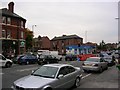
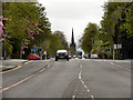
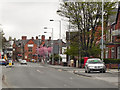
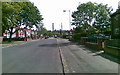
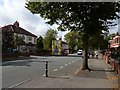
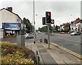
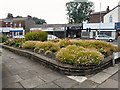
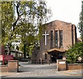

89 photos from this area
Area Information
Key information about the SK4 5HH including its size, population, and administrative classification.
- Area Type
- Postcode
- Area Size
- 1.1 hectares
- Population
- 1476
- Population Density
- 6005 people/km²
House Prices in SK4 5HH
27
Properties
£201,769
Average Sold Price
£85,000
Lowest Price
£325,000
Highest Price
Showing 27 properties
| Address | Type | Beds | Baths | Last Sale Price | Last Sale Date | |
|---|---|---|---|---|---|---|
| 226 Broadstone Road, Heaton Chapel, Stockport, SK4 5HH | house | - | - | £325,000 | Aug 2019 | |
| 263 Broadstone Road, Heaton Chapel, Stockport, SK4 5HH | house | - | - | £310,000 | Oct 2016 | |
| 267 Broadstone Road, Heaton Chapel, Stockport, SK4 5HH | house | - | - | £250,000 | Dec 2013 | |
| 281 Broadstone Road, Heaton Chapel, Stockport, SK4 5HH | house | - | - | £245,000 | Nov 2013 | |
| 218 Broadstone Road, Heaton Chapel, Stockport, SK4 5HH | house | - | - | £165,000 | Dec 2012 | |
| 259 Broadstone Road, Heaton Chapel, Stockport, SK4 5HH | Semi-detached | - | - | £179,248 | Sep 2008 | |
| 255 Broadstone Road, Heaton Chapel, Stockport, SK4 5HH | Semi-detached | - | - | £263,450 | Nov 2006 | |
| 253 Broadstone Road, Heaton Chapel, Stockport, SK4 5HH | Semi-detached | - | - | £279,950 | Nov 2006 | |
| 220 Broadstone Road, Heaton Chapel, Stockport, SK4 5HH | Semi-detached | - | - | £225,000 | Aug 2006 | |
| 275 Broadstone Road, Heaton Chapel, Stockport, SK4 5HH | house | - | - | £230,750 | Nov 2005 |
Page 1 of 3
Energy Efficiency in SK4 5HH
Amenities
Schools
| Rank | School | Type | Entry gender | Ages |
|---|
Explore more schools in this area
Go to Schools tabDemographics
Household Size
Family (3-5 people)
most common
Accommodation Type
Houses
most common
Tenure
88
majority
Ethnic Group
White
most common
Religion
N/A
most common
Household Composition
N/A
most common
Age
47
median
Adults (30-64 years)
most common
Household Deprivation
N/A
with no deprivation
NS-SEC
44
in Lower managerial occupations
Explore more demographic insights in this area
Go to Demographics tabPlanning
Planning Constraints
- Flood RiskPremium
- Ramsar Wetland SitesPremium
- Area of Outstanding Natural BeautyPremium
- Protected Nature ReservePremium
- Protected WoodlandPremium