Area Overview for SK4 4DP
Photos of SK4 4DP
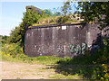

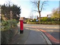

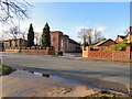

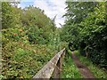

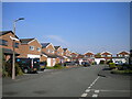
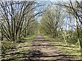
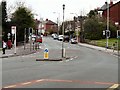
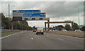
28 photos from this area
Area Information
Key information about the SK4 4DP including its size, population, and administrative classification.
- Area Type
- Postcode
- Area Size
- 1.0 hectares
- Population
- 1615
- Population Density
- 3680 people/km²
House Prices in SK4 4DP
33
Properties
£184,850
Average Sold Price
£69,450
Lowest Price
£440,000
Highest Price
Showing 33 properties
| Address | Type | Beds | Baths | Last Sale Price | Last Sale Date | |
|---|---|---|---|---|---|---|
| 62 Bankhall Road, Heaton Mersey, Stockport, SK4 4DP | house | - | - | £120,000 | Sep 2020 | |
| 53 Bankhall Road, Heaton Mersey, Stockport, SK4 4DP | Terraced | 3 | 1 | £320,000 | Jun 2020 | |
| 75 Bankhall Road, Heaton Mersey, Stockport, SK4 4DP | Detached | 4 | 2 | £440,000 | Jun 2019 | |
| 51 Bankhall Road, Heaton Mersey, Stockport, SK4 4DP | Terraced | 2 | 1 | £232,500 | Apr 2019 | |
| 65 Bankhall Road, Heaton Mersey, Stockport, SK4 4DP | house | - | - | £186,000 | Nov 2014 | |
| 55 Bankhall Road, Heaton Mersey, Stockport, SK4 4DP | house | - | - | £245,000 | Jul 2014 | |
| 60 Bankhall Road, Heaton Mersey, Stockport, SK4 4DP | house | - | - | £179,000 | Feb 2014 | |
| 42 Bankhall Road, Heaton Mersey, Stockport, SK4 4DP | Semi-detached | - | - | £210,000 | Mar 2007 | |
| 67 Bankhall Road, Heaton Mersey, Stockport, SK4 4DP | house | - | - | £187,000 | Mar 2007 | |
| 36 Bankhall Road, Heaton Mersey, Stockport, SK4 4DP | Semi-detached | - | - | £197,500 | Sep 2006 |
Page 1 of 4
Energy Efficiency in SK4 4DP
Amenities
Schools
| Rank | School | Type | Entry gender | Ages |
|---|
Explore more schools in this area
Go to Schools tabDemographics
Household Size
Family (3-5 people)
most common
Accommodation Type
Houses
most common
Tenure
61
majority
Ethnic Group
White
most common
Religion
N/A
most common
Household Composition
N/A
most common
Age
47
median
Adults (30-64 years)
most common
Household Deprivation
N/A
with no deprivation
NS-SEC
33
in Lower managerial occupations
Explore more demographic insights in this area
Go to Demographics tabPlanning
Planning Constraints
- Flood RiskPremium
- Ramsar Wetland SitesPremium
- Area of Outstanding Natural BeautyPremium
- Protected Nature ReservePremium
- Protected WoodlandPremium