Area Overview for SK4 4DH
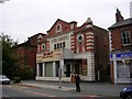
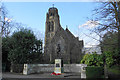
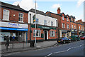
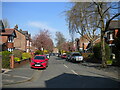
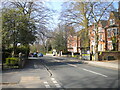
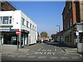
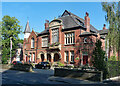
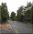
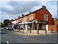
Photos of SK4 4DH


Area Information
SK4 4DH represents a very specific residential cluster in England, covering a total area of 1059 square metres. This precise postcode serves 1482 residents who live within this compact footprint, resulting in an extremely high population density of 1399053 people per square kilometre. Living in this particular location means navigating a tightly packed environment where space is at a premium. The area is distinct for its concentration of households within such a small geographical boundary. While the size suggests a small community, the sheer number of people indicates a significant level of activity for its dimensions. Prospective buyers should understand that they are entering a defined postcode zone that functions as a micro-community. The residents here are established in this unique cluster, creating a neighbourhood that operates on a small scale despite its urban intensity.
- Area Type
- Postcode
- Area Size
- 1059 m²
- Population
- 1482
- Population Density
- 4338 people/km²
This small postcode area functions primarily as an owner-occupied market rather than a rental hub. The data shows that 79 per cent of residents own their homes, which stands in stark contrast to areas where renting is common. Since the predominant accommodation type is houses, you will not find a concentration of flats or maisonettes here. The high home ownership rate indicates that many families have invested significantly in this specific location over time. For buyers looking at SK4 4DH, the market reflects a desire for ownership rather than tenancy. The small physical size of the area, measured at 1059 m², means every property is close to its neighbours. This density creates a tight-knit market where homes are closely affiliated with the broader community. You should expect to compete in an area where purchase is the norm for the vast majority of households.
House Prices in SK4 4DH
Showing 11 properties
Energy Efficiency in SK4 4DH
Residents of SK4 4DH have access to a range of amenities within practical reach, enhancing daily convenience. Five retail locations serve the community, including the notable Tesco Heaton and two Co-op stores in Stockport. Five railway stations are nearby, with Heaton Chapel, Burnage, and Mauldeth Road offering regular train services to the wider region. Five metro stations provide additional transport options, including access to East Didsbury, Didsbury Village, and West Didsbury. A bus service connects the area to Chorlton Street Coach Station. Five airports, including terminals one, two, and three, are accessible from this location, facilitating travel. This network of five-plus retail outlets, five railheads, and airport access points creates a highly connected lifestyle. You can shop, commute, and travel without leaving the immediate vicinity of this postcode cluster.
Amenities
Schools
One primary educational institution serves the immediate vicinity of this postcode. Heaton Moor Infant School stands as the designated primary school for families in SK4 4DH. As an infant school, it caters to the younger stages of a child's education, typically covering reception through Year 2. The presence of this specific school type means that you will find early years education facilities within practical reach of your home. While secondary education options are not listed in the available data for this immediate cluster, the availability of Heaton Moor Infant School provides a crucial starting point for local families. Parents relying on schools near SK4 4DH will find this institution a key part of their daily routine. The proximity of this school ensures that young children can access education without needing to travel to other towns for their primary schooling.
| Rank | School | Type | Entry gender | Ages |
|---|
Explore more schools in this area
Go to Schools tabDemographics
The community in SK4 4DH is dominated by adults, with the most common age range falling between 30 and 64 years. The median age for residents is precisely 47 years, confirming a mature population profile. You will find that 79 per cent of households in this postcode own their homes, indicating a stable environment where long-term residents have settled. The predominant accommodation type consists of houses, which aligns with the high rate of home ownership. The racial makeup of the area is predominantly White, reflecting the local demographic patterns. This profile suggests a neighbourhood composed primarily of families and individuals who have made a permanent commitment to these specific streets. The high percentage of owner-occupied properties means you are likely to encounter established neighbours who value stability and local connection.
Household Size
Accommodation Type
Tenure
Ethnic Group
Religion
Household Composition
Age
Household Deprivation
NS-SEC
Explore more demographic insights in this area
Go to Demographics tabPlanning
Planning Constraints
- Flood RiskPremium
- Ramsar Wetland SitesPremium
- Area of Outstanding Natural BeautyPremium
- Protected Nature ReservePremium
- Protected WoodlandPremium