Area Overview for SK4 2LT
Photos of SK4 2LT


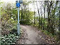


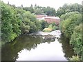
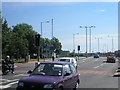
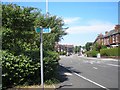
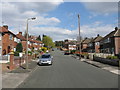
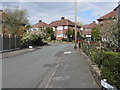
100 photos from this area
Area Information
Key information about the SK4 2LT including its size, population, and administrative classification.
- Area Type
- Postcode
- Area Size
- 4.0 hectares
- Population
- 1543
- Population Density
- 3192 people/km²
House Prices in SK4 2LT
41
Properties
£220,083
Average Sold Price
£42,500
Lowest Price
£610,000
Highest Price
Showing 41 properties
| Address | Type | Beds | Baths | Last Sale Price | Last Sale Date | |
|---|---|---|---|---|---|---|
| 48 Bowerfold Lane, Heaton Norris, Stockport, SK4 2LT | Detached | 5 | 2 | £610,000 | Jun 2025 | |
| 43 Bowerfold Lane, Heaton Norris, Stockport, SK4 2LT | Semi-detached | 4 | 1 | £425,000 | Mar 2025 | |
| 37 Bowerfold Lane, Heaton Norris, Stockport, SK4 2LT | Semi-detached | 4 | 1 | £360,000 | Aug 2024 | |
| 36 Bowerfold Lane, Heaton Norris, Stockport, SK4 2LT | house | - | - | £296,500 | Sep 2023 | |
| 16 Bowerfold Lane, Heaton Norris, Stockport, SK4 2LT | Semi-detached | 2 | 1 | £265,000 | Jul 2022 | |
| 19 Bowerfold Lane, Heaton Norris, Stockport, SK4 2LT | house | - | - | £346,000 | Jul 2022 | |
| 29 Bowerfold Lane, Heaton Norris, Stockport, SK4 2LT | Bungalow | - | - | £277,500 | Oct 2020 | |
| 24 Bowerfold Lane, Heaton Norris, Stockport, SK4 2LT | Semi-detached | 3 | 1 | £272,000 | Jul 2020 | |
| 17 Bowerfold Lane, Heaton Norris, Stockport, SK4 2LT | house | - | - | £325,000 | Nov 2018 | |
| 21 Bowerfold Lane, Heaton Norris, Stockport, SK4 2LT | house | - | - | £270,000 | Sep 2016 |
Page 1 of 5
Energy Efficiency in SK4 2LT
Amenities
Schools
| Rank | School | Type | Entry gender | Ages |
|---|
Explore more schools in this area
Go to Schools tabDemographics
Household Size
One person
most common
Accommodation Type
Houses
most common
Tenure
71
majority
Ethnic Group
White
most common
Religion
N/A
most common
Household Composition
N/A
most common
Age
47
median
Adults (30-64 years)
most common
Household Deprivation
N/A
with no deprivation
NS-SEC
43
in Lower managerial occupations
Explore more demographic insights in this area
Go to Demographics tabPlanning
Planning Constraints
- Flood RiskPremium
- Ramsar Wetland SitesPremium
- Area of Outstanding Natural BeautyPremium
- Protected Nature ReservePremium
- Protected WoodlandPremium