Area Overview for SK4 2JF
Photos of SK4 2JF


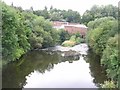
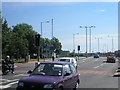
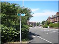
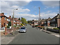
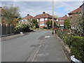
100 photos from this area
Area Information
Key information about the SK4 2JF including its size, population, and administrative classification.
- Area Type
- Postcode
- Area Size
- 8053 m²
- Population
- 1602
- Population Density
- 2875 people/km²
House Prices in SK4 2JF
14
Properties
£267,486
Average Sold Price
£93,450
Lowest Price
£424,000
Highest Price
Showing 14 properties
| Address | Type | Beds | Baths | Last Sale Price | Last Sale Date | |
|---|---|---|---|---|---|---|
| 12 St Martins Avenue, Heaton Norris, Stockport, SK4 2JF | Detached | 3 | 1 | £424,000 | Mar 2025 | |
| 14 St Martins Avenue, Heaton Norris, Stockport, SK4 2JF | house | - | - | £360,000 | Oct 2020 | |
| 13 St Martins Avenue, Heaton Norris, Stockport, SK4 2JF | Detached | 4 | 1 | £380,000 | Oct 2019 | |
| 7 St Martins Avenue, Heaton Norris, Stockport, SK4 2JF | Detached | - | - | £279,950 | Oct 2007 | |
| 2 St Martins Avenue, Heaton Norris, Stockport, SK4 2JF | Retail | 5 | 1 | £219,000 | Aug 2004 | |
| 1 St Martins Avenue, Heaton Norris, Stockport, SK4 2JF | Detached | - | - | £116,000 | Jul 2001 | |
| 10 St Martins Avenue, Heaton Norris, Stockport, SK4 2JF | Detached | - | - | £93,450 | Nov 1998 | |
| 6 St Martins Avenue, Heaton Norris, Stockport, SK4 2JF | Detached | 5 | 1 | - | - | |
| 8 St Martins Avenue, Heaton Norris, Stockport, SK4 2JF | Detached | - | - | - | - | |
| 11 St Martins Avenue, Heaton Norris, Stockport, SK4 2JF | house | - | - | - | - |
Page 1 of 2
Energy Efficiency in SK4 2JF
Amenities
Schools
| Rank | School | Type | Entry gender | Ages |
|---|
Explore more schools in this area
Go to Schools tabDemographics
Household Size
Family (3-5 people)
most common
Accommodation Type
Houses
most common
Tenure
81
majority
Ethnic Group
White
most common
Religion
N/A
most common
Household Composition
N/A
most common
Age
47
median
Adults (30-64 years)
most common
Household Deprivation
N/A
with no deprivation
NS-SEC
43
in Lower managerial occupations
Explore more demographic insights in this area
Go to Demographics tabPlanning
Planning Constraints
- Flood RiskPremium
- Ramsar Wetland SitesPremium
- Area of Outstanding Natural BeautyPremium
- Protected Nature ReservePremium
- Protected WoodlandPremium